You are here: Home > Network List > TA - USArray Transportable Network (new EarthScope stations) Stations List
> Station S56A Natural Bridge, VA, USA > Earthquake Result Viewer
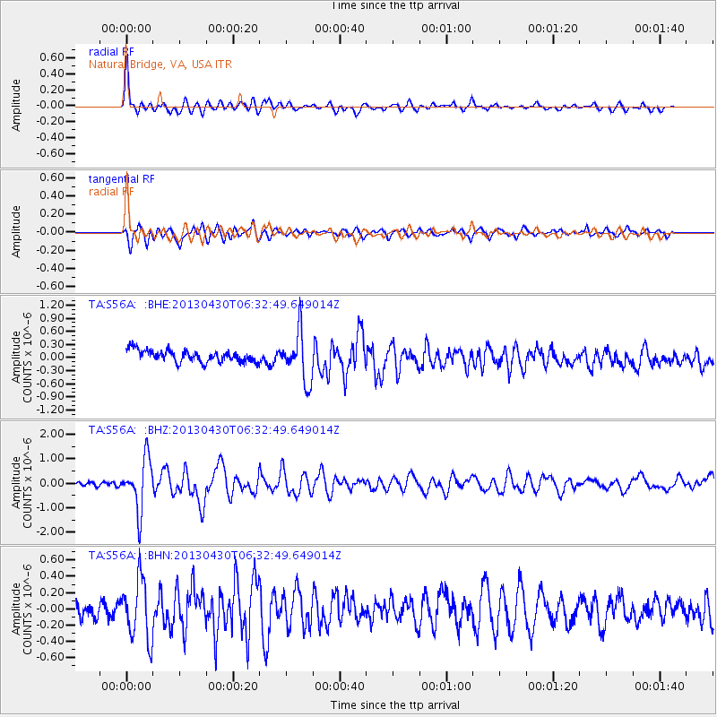
S56A Natural Bridge, VA, USA - Earthquake Result Viewer
*The percent match for this event was below the threshold and hence no stack was calculated.
| Earthquake location: |
Azores Islands Region |
| Earthquake latitude/longitude: |
37.6/-24.9 |
| Earthquake time(UTC): |
2013/04/30 (120) 06:25:23 GMT |
| Earthquake Depth: |
10 km |
| Earthquake Magnitude: |
5.8 MW, 5.9 MW, 5.9 MB |
| Earthquake Catalog/Contributor: |
NEIC PDE/NEIC PDE-W |
|
| Network: |
TA USArray Transportable Network (new EarthScope stations) |
| Station: |
S56A Natural Bridge, VA, USA |
| Lat/Lon: |
37.68 N/79.57 W |
| Elevation: |
449 m |
|
| Distance: |
42.7 deg |
| Az: |
287.546 deg |
| Baz: |
72.661 deg |
| Ray Param: |
$rayparam |
*The percent match for this event was below the threshold and hence was not used in the summary stack. |
|
| Radial Match: |
71.14949 % |
| Radial Bump: |
400 |
| Transverse Match: |
75.26684 % |
| Transverse Bump: |
400 |
| SOD ConfigId: |
512894 |
| Insert Time: |
2013-09-13 21:12:44.123 +0000 |
| GWidth: |
2.5 |
| Max Bumps: |
400 |
| Tol: |
0.001 |
|
Signal To Noise
| Channel | StoN | STA | LTA |
| TA:S56A: :BHZ:20130430T06:32:49.649014Z | 8.102566 | 1.0539455E-6 | 1.3007552E-7 |
| TA:S56A: :BHN:20130430T06:32:49.649014Z | 2.9293303 | 3.7152338E-7 | 1.2682878E-7 |
| TA:S56A: :BHE:20130430T06:32:49.649014Z | 4.2122064 | 5.6919475E-7 | 1.3512984E-7 |
| Arrivals |
| Ps | |
| PpPs | |
| PsPs/PpSs | |


