You are here: Home > Network List > TA - USArray Transportable Network (new EarthScope stations) Stations List
> Station U59A Littleton, NC, USA > Earthquake Result Viewer
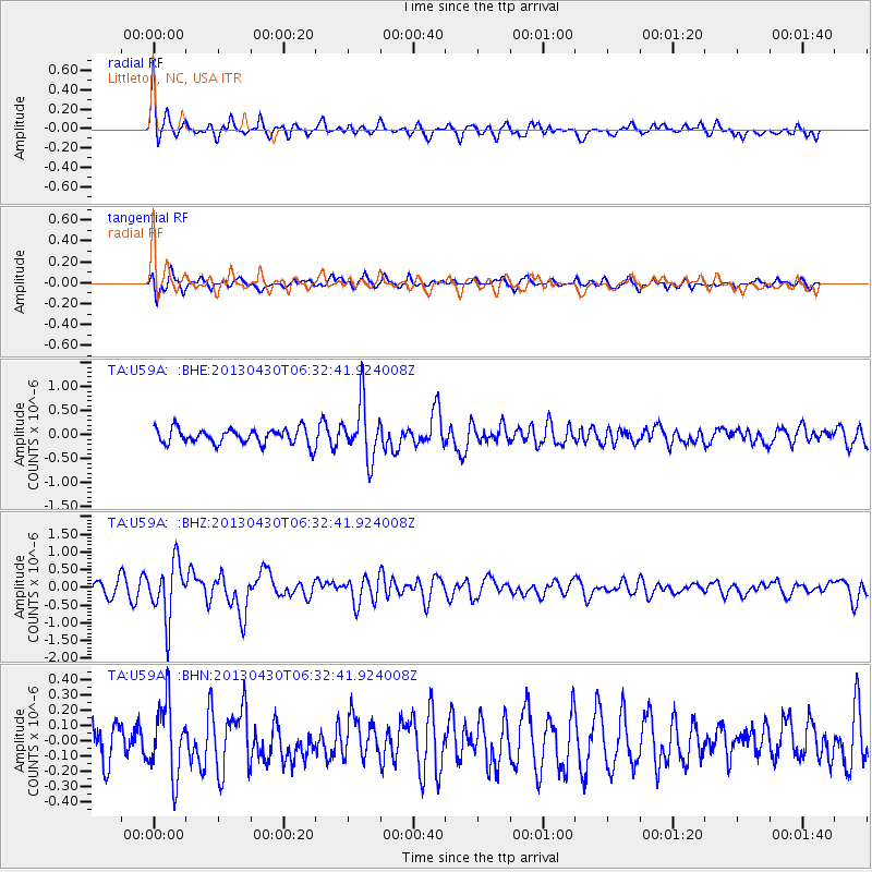
U59A Littleton, NC, USA - Earthquake Result Viewer
*The percent match for this event was below the threshold and hence no stack was calculated.
| Earthquake location: |
Azores Islands Region |
| Earthquake latitude/longitude: |
37.6/-24.9 |
| Earthquake time(UTC): |
2013/04/30 (120) 06:25:23 GMT |
| Earthquake Depth: |
10 km |
| Earthquake Magnitude: |
5.8 MW, 5.9 MW, 5.9 MB |
| Earthquake Catalog/Contributor: |
NEIC PDE/NEIC PDE-W |
|
| Network: |
TA USArray Transportable Network (new EarthScope stations) |
| Station: |
U59A Littleton, NC, USA |
| Lat/Lon: |
36.35 N/77.79 W |
| Elevation: |
99 m |
|
| Distance: |
41.8 deg |
| Az: |
285.031 deg |
| Baz: |
71.863 deg |
| Ray Param: |
$rayparam |
*The percent match for this event was below the threshold and hence was not used in the summary stack. |
|
| Radial Match: |
75.235954 % |
| Radial Bump: |
400 |
| Transverse Match: |
68.63778 % |
| Transverse Bump: |
400 |
| SOD ConfigId: |
512894 |
| Insert Time: |
2013-09-13 21:15:27.567 +0000 |
| GWidth: |
2.5 |
| Max Bumps: |
400 |
| Tol: |
0.001 |
|
Signal To Noise
| Channel | StoN | STA | LTA |
| TA:U59A: :BHZ:20130430T06:32:41.924008Z | 3.1106865 | 7.999509E-7 | 2.5716216E-7 |
| TA:U59A: :BHN:20130430T06:32:41.924008Z | 1.6896217 | 2.339455E-7 | 1.3846028E-7 |
| TA:U59A: :BHE:20130430T06:32:41.924008Z | 3.656103 | 5.8538785E-7 | 1.6011252E-7 |
| Arrivals |
| Ps | |
| PpPs | |
| PsPs/PpSs | |


