You are here: Home > Network List > PS - Pacific21 Stations List
> Station PSI Parapat, Indonesia > Earthquake Result Viewer
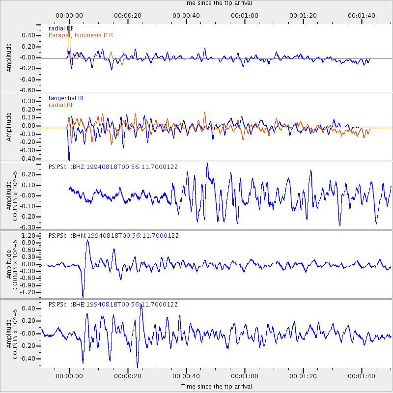
PSI Parapat, Indonesia - Earthquake Result Viewer
*The percent match for this event was below the threshold and hence no stack was calculated.
| Earthquake location: |
Lake Tanganyika Region |
| Earthquake latitude/longitude: |
-7.3/31.8 |
| Earthquake time(UTC): |
1994/08/18 (230) 00:45:48 GMT |
| Earthquake Depth: |
29 km |
| Earthquake Magnitude: |
6.0 MB, 5.8 MS, 6.1 UNKNOWN, 5.9 MW |
| Earthquake Catalog/Contributor: |
WHDF/NEIC |
|
| Network: |
PS Pacific21 |
| Station: |
PSI Parapat, Indonesia |
| Lat/Lon: |
2.69 N/98.92 E |
| Elevation: |
987 m |
|
| Distance: |
67.7 deg |
| Az: |
84.071 deg |
| Baz: |
260.998 deg |
| Ray Param: |
$rayparam |
*The percent match for this event was below the threshold and hence was not used in the summary stack. |
|
| Radial Match: |
80.68025 % |
| Radial Bump: |
400 |
| Transverse Match: |
80.85153 % |
| Transverse Bump: |
400 |
| SOD ConfigId: |
4480 |
| Insert Time: |
2010-02-27 03:24:50.436 +0000 |
| GWidth: |
2.5 |
| Max Bumps: |
400 |
| Tol: |
0.001 |
|
Signal To Noise
| Channel | StoN | STA | LTA |
| PS:PSI: :BHN:19940818T00:56:11.700012Z | 10.732213 | 4.1381716E-7 | 3.855842E-8 |
| PS:PSI: :BHE:19940818T00:56:11.700012Z | 4.087738 | 1.4681872E-7 | 3.5916862E-8 |
| PS:PSI: :BHZ:19940818T00:56:11.700012Z | 1.1124756 | 3.989597E-8 | 3.586233E-8 |
| Arrivals |
| Ps | |
| PpPs | |
| PsPs/PpSs | |


