You are here: Home > Network List > UW - Pacific Northwest Regional Seismic Network Stations List
> Station UMAT Pilot Rock, OR, USA > Earthquake Result Viewer
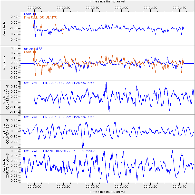
UMAT Pilot Rock, OR, USA - Earthquake Result Viewer
*The percent match for this event was below the threshold and hence no stack was calculated.
| Earthquake location: |
Northern Mid-Atlantic Ridge |
| Earthquake latitude/longitude: |
35.1/-36.3 |
| Earthquake time(UTC): |
2014/07/29 (210) 22:04:40 GMT |
| Earthquake Depth: |
0.0 km |
| Earthquake Magnitude: |
5.6 MW, 4.8 ms1mx, 4.9 Ms1, 4.8 MS, 4.5 mbtmp, 4.5 mb1mx, 4.6 mb1, 4.5 mb |
| Earthquake Catalog/Contributor: |
ISC/ISC |
|
| Network: |
UW Pacific Northwest Regional Seismic Network |
| Station: |
UMAT Pilot Rock, OR, USA |
| Lat/Lon: |
45.29 N/118.96 W |
| Elevation: |
1318 m |
|
| Distance: |
61.3 deg |
| Az: |
307.072 deg |
| Baz: |
67.901 deg |
| Ray Param: |
$rayparam |
*The percent match for this event was below the threshold and hence was not used in the summary stack. |
|
| Radial Match: |
46.432777 % |
| Radial Bump: |
400 |
| Transverse Match: |
45.471455 % |
| Transverse Bump: |
400 |
| SOD ConfigId: |
3390531 |
| Insert Time: |
2019-04-13 02:30:15.563 +0000 |
| GWidth: |
2.5 |
| Max Bumps: |
400 |
| Tol: |
0.001 |
|
Signal To Noise
| Channel | StoN | STA | LTA |
| UW:UMAT: :HHZ:20140729T22:14:26.487996Z | 2.9452817 | 8.9084836E-8 | 3.0246625E-8 |
| UW:UMAT: :HHN:20140729T22:14:26.487996Z | 1.3431423 | 5.0937174E-8 | 3.7923886E-8 |
| UW:UMAT: :HHE:20140729T22:14:26.487996Z | 0.72455806 | 2.2468164E-8 | 3.1009474E-8 |
| Arrivals |
| Ps | |
| PpPs | |
| PsPs/PpSs | |


