You are here: Home > Network List > TA - USArray Transportable Network (new EarthScope stations) Stations List
> Station Z59A Georgetown, SC, USA > Earthquake Result Viewer
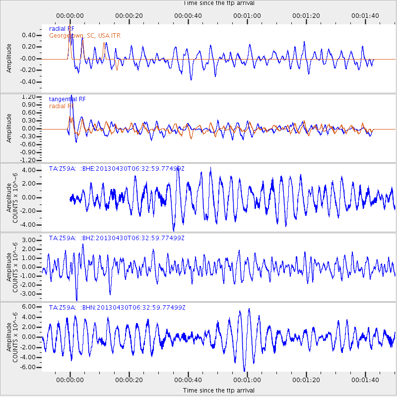
Z59A Georgetown, SC, USA - Earthquake Result Viewer
*The percent match for this event was below the threshold and hence no stack was calculated.
| Earthquake location: |
Azores Islands Region |
| Earthquake latitude/longitude: |
37.6/-24.9 |
| Earthquake time(UTC): |
2013/04/30 (120) 06:25:23 GMT |
| Earthquake Depth: |
10 km |
| Earthquake Magnitude: |
5.8 MW, 5.9 MW, 5.9 MB |
| Earthquake Catalog/Contributor: |
NEIC PDE/NEIC PDE-W |
|
| Network: |
TA USArray Transportable Network (new EarthScope stations) |
| Station: |
Z59A Georgetown, SC, USA |
| Lat/Lon: |
33.24 N/79.28 W |
| Elevation: |
8.0 m |
|
| Distance: |
44.0 deg |
| Az: |
281.356 deg |
| Baz: |
68.326 deg |
| Ray Param: |
$rayparam |
*The percent match for this event was below the threshold and hence was not used in the summary stack. |
|
| Radial Match: |
37.360374 % |
| Radial Bump: |
381 |
| Transverse Match: |
48.543655 % |
| Transverse Bump: |
400 |
| SOD ConfigId: |
512894 |
| Insert Time: |
2013-09-13 21:19:39.943 +0000 |
| GWidth: |
2.5 |
| Max Bumps: |
400 |
| Tol: |
0.001 |
|
Signal To Noise
| Channel | StoN | STA | LTA |
| TA:Z59A: :BHZ:20130430T06:32:59.77499Z | 2.3491094 | 1.5384788E-6 | 6.5492003E-7 |
| TA:Z59A: :BHN:20130430T06:32:59.77499Z | 1.5589433 | 2.7472754E-6 | 1.7622677E-6 |
| TA:Z59A: :BHE:20130430T06:32:59.77499Z | 1.1798064 | 1.3456341E-6 | 1.1405551E-6 |
| Arrivals |
| Ps | |
| PpPs | |
| PsPs/PpSs | |


