You are here: Home > Network List > PS - Pacific21 Stations List
> Station PSI Parapat, Indonesia > Earthquake Result Viewer
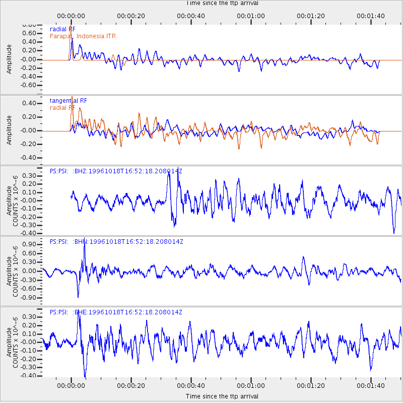
PSI Parapat, Indonesia - Earthquake Result Viewer
*The percent match for this event was below the threshold and hence no stack was calculated.
| Earthquake location: |
Near S. Coast Of Honshu, Japan |
| Earthquake latitude/longitude: |
33.7/137.4 |
| Earthquake time(UTC): |
1996/10/18 (292) 16:44:47 GMT |
| Earthquake Depth: |
338 km |
| Earthquake Magnitude: |
5.6 UNKNOWN, 5.4 MB, 5.6 MW |
| Earthquake Catalog/Contributor: |
WHDF/NEIC |
|
| Network: |
PS Pacific21 |
| Station: |
PSI Parapat, Indonesia |
| Lat/Lon: |
2.69 N/98.92 E |
| Elevation: |
987 m |
|
| Distance: |
47.3 deg |
| Az: |
237.711 deg |
| Baz: |
44.882 deg |
| Ray Param: |
$rayparam |
*The percent match for this event was below the threshold and hence was not used in the summary stack. |
|
| Radial Match: |
54.956005 % |
| Radial Bump: |
400 |
| Transverse Match: |
54.763306 % |
| Transverse Bump: |
400 |
| SOD ConfigId: |
4480 |
| Insert Time: |
2010-02-27 03:25:08.631 +0000 |
| GWidth: |
2.5 |
| Max Bumps: |
400 |
| Tol: |
0.001 |
|
Signal To Noise
| Channel | StoN | STA | LTA |
| PS:PSI: :BHN:19961018T16:52:18.208014Z | 4.8274403 | 3.5611592E-7 | 7.37691E-8 |
| PS:PSI: :BHE:19961018T16:52:18.208014Z | 2.7348888 | 1.9117722E-7 | 6.99031E-8 |
| PS:PSI: :BHZ:19961018T16:52:18.208014Z | 2.9162908 | 1.7226915E-7 | 5.9071322E-8 |
| Arrivals |
| Ps | |
| PpPs | |
| PsPs/PpSs | |


