You are here: Home > Network List > US - United States National Seismic Network Stations List
> Station DGMT Dagmar, Montana, USA > Earthquake Result Viewer
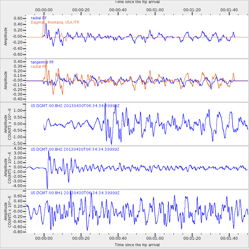
DGMT Dagmar, Montana, USA - Earthquake Result Viewer
*The percent match for this event was below the threshold and hence no stack was calculated.
| Earthquake location: |
Azores Islands Region |
| Earthquake latitude/longitude: |
37.6/-24.9 |
| Earthquake time(UTC): |
2013/04/30 (120) 06:25:23 GMT |
| Earthquake Depth: |
10 km |
| Earthquake Magnitude: |
5.8 MW, 5.9 MW, 5.9 MB |
| Earthquake Catalog/Contributor: |
NEIC PDE/NEIC PDE-W |
|
| Network: |
US United States National Seismic Network |
| Station: |
DGMT Dagmar, Montana, USA |
| Lat/Lon: |
48.47 N/104.20 W |
| Elevation: |
0.0 m |
|
| Distance: |
56.5 deg |
| Az: |
308.37 deg |
| Baz: |
69.359 deg |
| Ray Param: |
$rayparam |
*The percent match for this event was below the threshold and hence was not used in the summary stack. |
|
| Radial Match: |
78.36953 % |
| Radial Bump: |
400 |
| Transverse Match: |
54.88762 % |
| Transverse Bump: |
400 |
| SOD ConfigId: |
512894 |
| Insert Time: |
2013-09-13 21:20:42.596 +0000 |
| GWidth: |
2.5 |
| Max Bumps: |
400 |
| Tol: |
0.001 |
|
Signal To Noise
| Channel | StoN | STA | LTA |
| US:DGMT:00:BHZ:20130430T06:34:34.39999Z | 16.896114 | 1.7349915E-6 | 1.0268583E-7 |
| US:DGMT:00:BH1:20130430T06:34:34.39999Z | 1.9339987 | 3.329851E-7 | 1.7217442E-7 |
| US:DGMT:00:BH2:20130430T06:34:34.39999Z | 3.3781433 | 5.910674E-7 | 1.7496814E-7 |
| Arrivals |
| Ps | |
| PpPs | |
| PsPs/PpSs | |


