You are here: Home > Network List > UW - Pacific Northwest Regional Seismic Network Stations List
> Station UMAT Pilot Rock, OR, USA > Earthquake Result Viewer
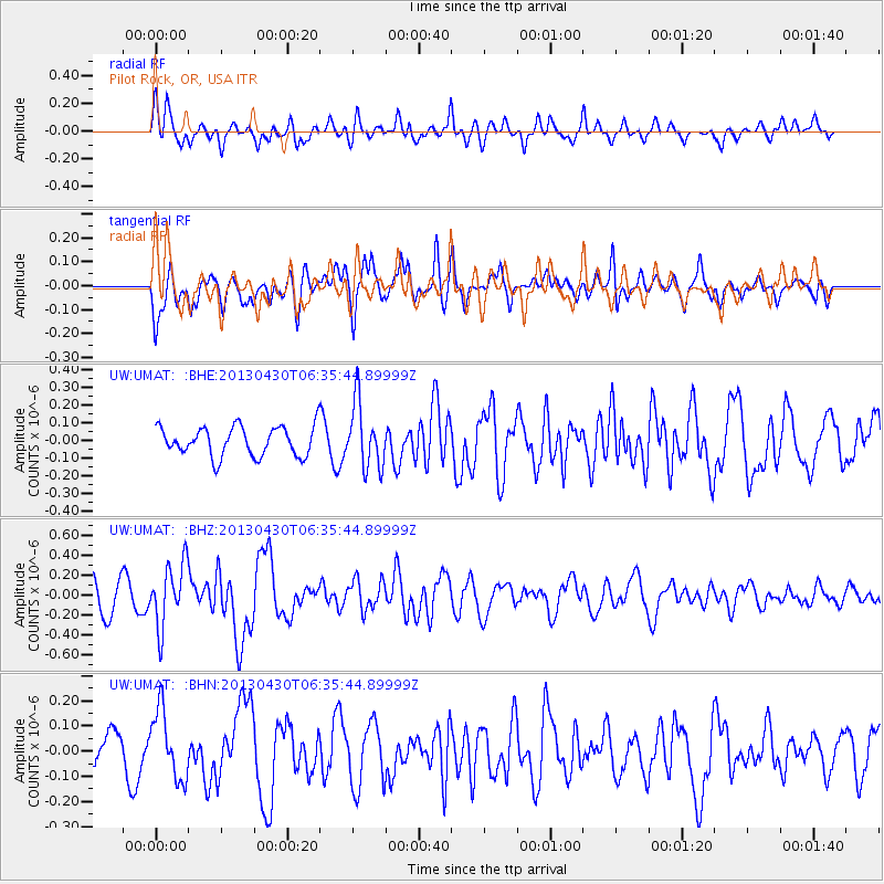
UMAT Pilot Rock, OR, USA - Earthquake Result Viewer
*The percent match for this event was below the threshold and hence no stack was calculated.
| Earthquake location: |
Azores Islands Region |
| Earthquake latitude/longitude: |
37.6/-24.9 |
| Earthquake time(UTC): |
2013/04/30 (120) 06:25:23 GMT |
| Earthquake Depth: |
10 km |
| Earthquake Magnitude: |
5.8 MW, 5.9 MW, 5.9 MB |
| Earthquake Catalog/Contributor: |
NEIC PDE/NEIC PDE-W |
|
| Network: |
UW Pacific Northwest Regional Seismic Network |
| Station: |
UMAT Pilot Rock, OR, USA |
| Lat/Lon: |
45.29 N/118.96 W |
| Elevation: |
1318 m |
|
| Distance: |
67.0 deg |
| Az: |
310.099 deg |
| Baz: |
59.405 deg |
| Ray Param: |
$rayparam |
*The percent match for this event was below the threshold and hence was not used in the summary stack. |
|
| Radial Match: |
71.14021 % |
| Radial Bump: |
400 |
| Transverse Match: |
68.66512 % |
| Transverse Bump: |
400 |
| SOD ConfigId: |
512894 |
| Insert Time: |
2013-09-13 21:25:15.664 +0000 |
| GWidth: |
2.5 |
| Max Bumps: |
400 |
| Tol: |
0.001 |
|
Signal To Noise
| Channel | StoN | STA | LTA |
| UW:UMAT: :BHZ:20130430T06:35:44.89999Z | 2.2781339 | 3.1280288E-7 | 1.3730663E-7 |
| UW:UMAT: :BHN:20130430T06:35:44.89999Z | 2.0965414 | 1.3616122E-7 | 6.494564E-8 |
| UW:UMAT: :BHE:20130430T06:35:44.89999Z | 2.2301168 | 1.8240084E-7 | 8.1789814E-8 |
| Arrivals |
| Ps | |
| PpPs | |
| PsPs/PpSs | |


