You are here: Home > Network List > IU - Global Seismograph Network (GSN - IRIS/USGS) Stations List
> Station CTAO Charters Towers, Australia > Earthquake Result Viewer
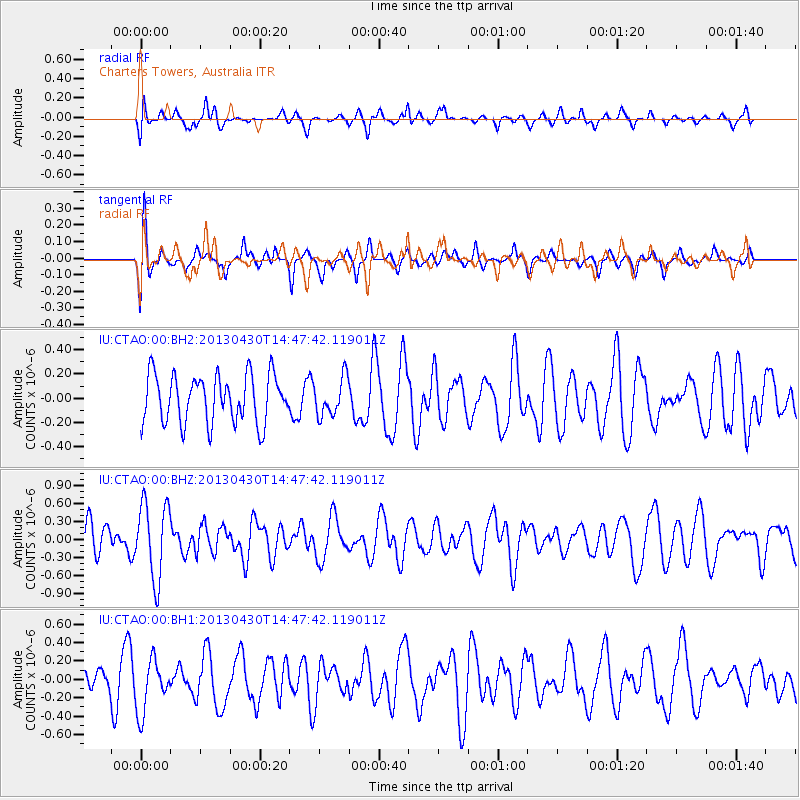
CTAO Charters Towers, Australia - Earthquake Result Viewer
*The percent match for this event was below the threshold and hence no stack was calculated.
| Earthquake location: |
Balleny Islands Region |
| Earthquake latitude/longitude: |
-65.4/179.5 |
| Earthquake time(UTC): |
2013/04/30 (120) 14:39:16 GMT |
| Earthquake Depth: |
10 km |
| Earthquake Magnitude: |
5.5 MW |
| Earthquake Catalog/Contributor: |
NEIC PDE/NEIC PDE-W |
|
| Network: |
IU Global Seismograph Network (GSN - IRIS/USGS) |
| Station: |
CTAO Charters Towers, Australia |
| Lat/Lon: |
20.09 S/146.25 E |
| Elevation: |
357 m |
|
| Distance: |
50.3 deg |
| Az: |
317.986 deg |
| Baz: |
162.651 deg |
| Ray Param: |
$rayparam |
*The percent match for this event was below the threshold and hence was not used in the summary stack. |
|
| Radial Match: |
52.710754 % |
| Radial Bump: |
400 |
| Transverse Match: |
57.103733 % |
| Transverse Bump: |
400 |
| SOD ConfigId: |
512894 |
| Insert Time: |
2013-09-13 21:32:50.096 +0000 |
| GWidth: |
2.5 |
| Max Bumps: |
400 |
| Tol: |
0.001 |
|
Signal To Noise
| Channel | StoN | STA | LTA |
| IU:CTAO:00:BHZ:20130430T14:47:42.119011Z | 2.0783544 | 6.355901E-7 | 3.058141E-7 |
| IU:CTAO:00:BH1:20130430T14:47:42.119011Z | 1.2861851 | 2.8604651E-7 | 2.2239917E-7 |
| IU:CTAO:00:BH2:20130430T14:47:42.119011Z | 0.7869855 | 1.5525347E-7 | 1.9727615E-7 |
| Arrivals |
| Ps | |
| PpPs | |
| PsPs/PpSs | |


