You are here: Home > Network List > PS - Pacific21 Stations List
> Station PSI Parapat, Indonesia > Earthquake Result Viewer
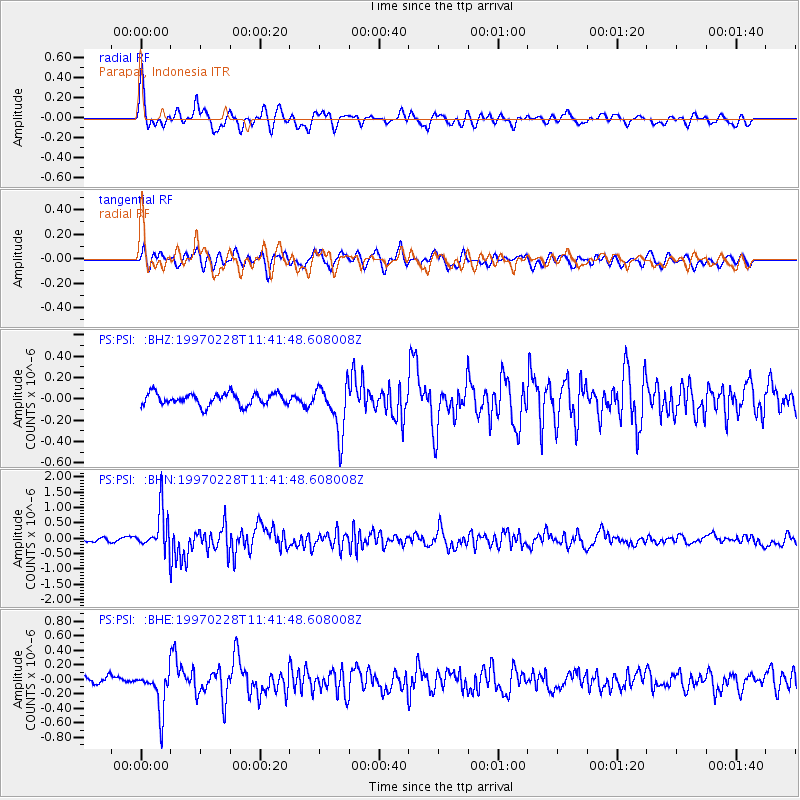
PSI Parapat, Indonesia - Earthquake Result Viewer
*The percent match for this event was below the threshold and hence no stack was calculated.
| Earthquake location: |
Kuril Islands |
| Earthquake latitude/longitude: |
43.9/147.9 |
| Earthquake time(UTC): |
1997/02/28 (059) 11:32:18 GMT |
| Earthquake Depth: |
33 km |
| Earthquake Magnitude: |
6.1 MB, 5.5 MS, 5.9 UNKNOWN, 5.7 MW |
| Earthquake Catalog/Contributor: |
WHDF/NEIC |
|
| Network: |
PS Pacific21 |
| Station: |
PSI Parapat, Indonesia |
| Lat/Lon: |
2.69 N/98.92 E |
| Elevation: |
987 m |
|
| Distance: |
59.6 deg |
| Az: |
240.877 deg |
| Baz: |
39.194 deg |
| Ray Param: |
$rayparam |
*The percent match for this event was below the threshold and hence was not used in the summary stack. |
|
| Radial Match: |
75.4569 % |
| Radial Bump: |
400 |
| Transverse Match: |
71.66734 % |
| Transverse Bump: |
400 |
| SOD ConfigId: |
4480 |
| Insert Time: |
2010-02-27 03:26:13.052 +0000 |
| GWidth: |
2.5 |
| Max Bumps: |
400 |
| Tol: |
0.001 |
|
Signal To Noise
| Channel | StoN | STA | LTA |
| PS:PSI: :BHN:19970228T11:41:48.608008Z | 8.311648 | 6.5746394E-7 | 7.910152E-8 |
| PS:PSI: :BHE:19970228T11:41:48.608008Z | 4.33648 | 2.8067345E-7 | 6.47238E-8 |
| PS:PSI: :BHZ:19970228T11:41:48.608008Z | 4.082699 | 2.3194751E-7 | 5.6812297E-8 |
| Arrivals |
| Ps | |
| PpPs | |
| PsPs/PpSs | |


