You are here: Home > Network List > PS - Pacific21 Stations List
> Station PSI Parapat, Indonesia > Earthquake Result Viewer
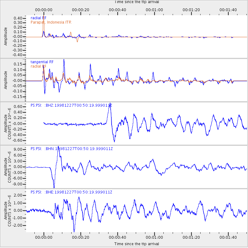
PSI Parapat, Indonesia - Earthquake Result Viewer
*The percent match for this event was below the threshold and hence no stack was calculated.
| Earthquake location: |
Fiji Islands Region |
| Earthquake latitude/longitude: |
-21.6/-176.4 |
| Earthquake time(UTC): |
1998/12/27 (361) 00:38:26 GMT |
| Earthquake Depth: |
144 km |
| Earthquake Magnitude: |
6.1 MB, 6.9 UNKNOWN, 6.6 ME |
| Earthquake Catalog/Contributor: |
WHDF/NEIC |
|
| Network: |
PS Pacific21 |
| Station: |
PSI Parapat, Indonesia |
| Lat/Lon: |
2.69 N/98.92 E |
| Elevation: |
987 m |
|
| Distance: |
86.1 deg |
| Az: |
274.441 deg |
| Baz: |
111.777 deg |
| Ray Param: |
$rayparam |
*The percent match for this event was below the threshold and hence was not used in the summary stack. |
|
| Radial Match: |
95.37599 % |
| Radial Bump: |
400 |
| Transverse Match: |
94.37044 % |
| Transverse Bump: |
400 |
| SOD ConfigId: |
4480 |
| Insert Time: |
2010-02-27 03:26:18.952 +0000 |
| GWidth: |
2.5 |
| Max Bumps: |
400 |
| Tol: |
0.001 |
|
Signal To Noise
| Channel | StoN | STA | LTA |
| PS:PSI: :BHN:19981227T00:50:19.999011Z | 25.772478 | 1.9224915E-6 | 7.4594745E-8 |
| PS:PSI: :BHE:19981227T00:50:19.999011Z | 2.289203 | 2.4073242E-7 | 1.05159934E-7 |
| PS:PSI: :BHZ:19981227T00:50:19.999011Z | 5.426359 | 9.540479E-8 | 1.7581732E-8 |
| Arrivals |
| Ps | |
| PpPs | |
| PsPs/PpSs | |


