You are here: Home > Network List > US - United States National Seismic Network Stations List
> Station MSO Missoula, Montana, USA > Earthquake Result Viewer
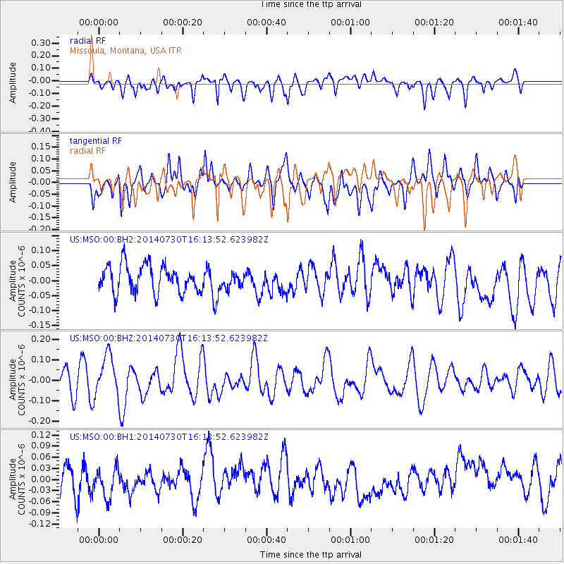
MSO Missoula, Montana, USA - Earthquake Result Viewer
*The percent match for this event was below the threshold and hence no stack was calculated.
| Earthquake location: |
Solomon Islands |
| Earthquake latitude/longitude: |
-7.2/154.8 |
| Earthquake time(UTC): |
2014/07/30 (211) 16:00:58 GMT |
| Earthquake Depth: |
10 km |
| Earthquake Magnitude: |
5.7 MWB |
| Earthquake Catalog/Contributor: |
NEIC PDE/NEIC COMCAT |
|
| Network: |
US United States National Seismic Network |
| Station: |
MSO Missoula, Montana, USA |
| Lat/Lon: |
46.83 N/113.94 W |
| Elevation: |
1264 m |
|
| Distance: |
96.0 deg |
| Az: |
43.651 deg |
| Baz: |
265.965 deg |
| Ray Param: |
$rayparam |
*The percent match for this event was below the threshold and hence was not used in the summary stack. |
|
| Radial Match: |
43.738903 % |
| Radial Bump: |
400 |
| Transverse Match: |
45.081707 % |
| Transverse Bump: |
400 |
| SOD ConfigId: |
3390531 |
| Insert Time: |
2019-04-13 02:47:01.652 +0000 |
| GWidth: |
2.5 |
| Max Bumps: |
400 |
| Tol: |
0.001 |
|
Signal To Noise
| Channel | StoN | STA | LTA |
| US:MSO:00:BHZ:20140730T16:13:52.623982Z | 1.7063254 | 9.945711E-8 | 5.8287306E-8 |
| US:MSO:00:BH1:20140730T16:13:52.623982Z | 1.0633072 | 4.033725E-8 | 3.7935656E-8 |
| US:MSO:00:BH2:20140730T16:13:52.623982Z | 0.47824284 | 2.1931562E-8 | 4.585863E-8 |
| Arrivals |
| Ps | |
| PpPs | |
| PsPs/PpSs | |


