You are here: Home > Network List > PS - Pacific21 Stations List
> Station PSI Parapat, Indonesia > Earthquake Result Viewer
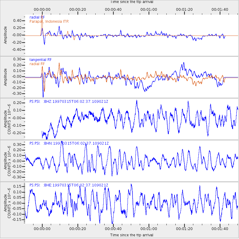
PSI Parapat, Indonesia - Earthquake Result Viewer
*The percent match for this event was below the threshold and hence no stack was calculated.
| Earthquake location: |
West Of Macquarie Island |
| Earthquake latitude/longitude: |
-59.8/149.9 |
| Earthquake time(UTC): |
1997/03/15 (074) 05:51:33 GMT |
| Earthquake Depth: |
10 km |
| Earthquake Magnitude: |
5.7 MS, 5.0 MB, 5.9 UNKNOWN |
| Earthquake Catalog/Contributor: |
WHDF/NEIC |
|
| Network: |
PS Pacific21 |
| Station: |
PSI Parapat, Indonesia |
| Lat/Lon: |
2.69 N/98.92 E |
| Elevation: |
987 m |
|
| Distance: |
73.9 deg |
| Az: |
306.127 deg |
| Baz: |
155.909 deg |
| Ray Param: |
$rayparam |
*The percent match for this event was below the threshold and hence was not used in the summary stack. |
|
| Radial Match: |
63.26177 % |
| Radial Bump: |
400 |
| Transverse Match: |
51.353813 % |
| Transverse Bump: |
400 |
| SOD ConfigId: |
4480 |
| Insert Time: |
2010-02-27 03:26:19.383 +0000 |
| GWidth: |
2.5 |
| Max Bumps: |
400 |
| Tol: |
0.001 |
|
Signal To Noise
| Channel | StoN | STA | LTA |
| PS:PSI: :BHN:19970315T06:02:37.109021Z | 1.0194921 | 7.383485E-8 | 7.242316E-8 |
| PS:PSI: :BHE:19970315T06:02:37.109021Z | 0.46147126 | 4.062092E-8 | 8.802481E-8 |
| PS:PSI: :BHZ:19970315T06:02:37.109021Z | 1.1790015 | 1.2115935E-7 | 1.0276438E-7 |
| Arrivals |
| Ps | |
| PpPs | |
| PsPs/PpSs | |


