You are here: Home > Network List > TA - USArray Transportable Network (new EarthScope stations) Stations List
> Station MDND Maddock, ND, USA > Earthquake Result Viewer
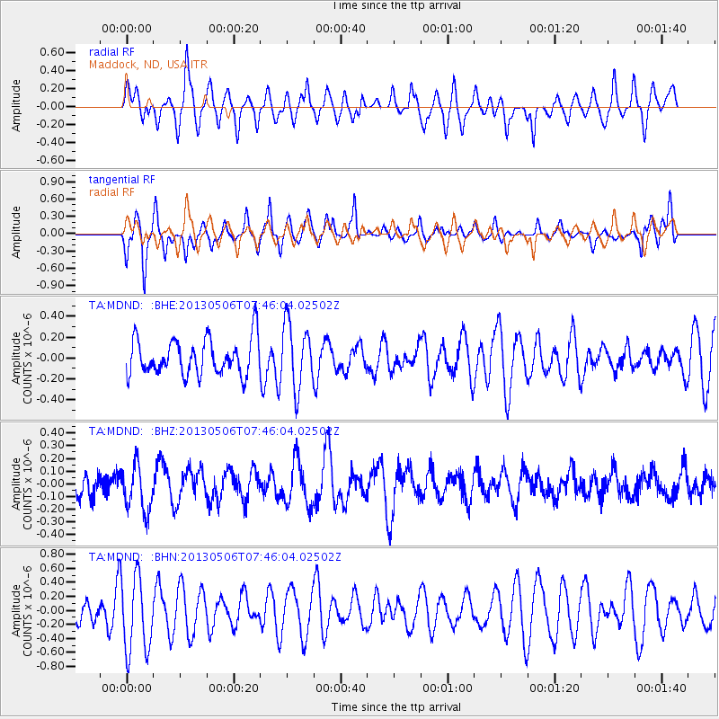
MDND Maddock, ND, USA - Earthquake Result Viewer
*The percent match for this event was below the threshold and hence no stack was calculated.
| Earthquake location: |
Fiji Islands Region |
| Earthquake latitude/longitude: |
-21.4/-176.3 |
| Earthquake time(UTC): |
2013/05/06 (126) 07:33:03 GMT |
| Earthquake Depth: |
9.9 km |
| Earthquake Magnitude: |
5.5 MW |
| Earthquake Catalog/Contributor: |
NEIC PDE/NEIC PDE-W |
|
| Network: |
TA USArray Transportable Network (new EarthScope stations) |
| Station: |
MDND Maddock, ND, USA |
| Lat/Lon: |
47.85 N/99.60 W |
| Elevation: |
479 m |
|
| Distance: |
97.1 deg |
| Az: |
41.34 deg |
| Baz: |
246.063 deg |
| Ray Param: |
$rayparam |
*The percent match for this event was below the threshold and hence was not used in the summary stack. |
|
| Radial Match: |
57.47375 % |
| Radial Bump: |
400 |
| Transverse Match: |
59.117077 % |
| Transverse Bump: |
324 |
| SOD ConfigId: |
512894 |
| Insert Time: |
2013-09-13 23:12:30.878 +0000 |
| GWidth: |
2.5 |
| Max Bumps: |
400 |
| Tol: |
0.001 |
|
Signal To Noise
| Channel | StoN | STA | LTA |
| TA:MDND: :BHZ:20130506T07:46:04.02502Z | 1.4360157 | 1.8328429E-7 | 1.276339E-7 |
| TA:MDND: :BHN:20130506T07:46:04.02502Z | 2.2768822 | 5.38239E-7 | 2.36393E-7 |
| TA:MDND: :BHE:20130506T07:46:04.02502Z | 1.8091718 | 3.103536E-7 | 1.7154458E-7 |
| Arrivals |
| Ps | |
| PpPs | |
| PsPs/PpSs | |


