You are here: Home > Network List > TA - USArray Transportable Network (new EarthScope stations) Stations List
> Station Y12C Blythe, CA, USA > Earthquake Result Viewer
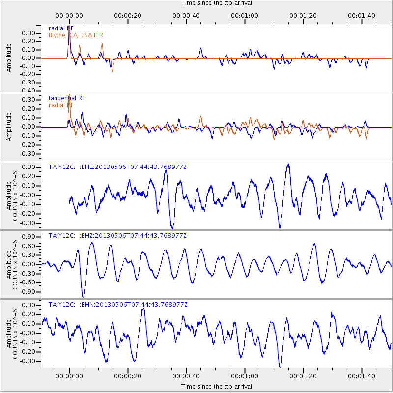
Y12C Blythe, CA, USA - Earthquake Result Viewer
*The percent match for this event was below the threshold and hence no stack was calculated.
| Earthquake location: |
Fiji Islands Region |
| Earthquake latitude/longitude: |
-21.4/-176.3 |
| Earthquake time(UTC): |
2013/05/06 (126) 07:33:03 GMT |
| Earthquake Depth: |
9.9 km |
| Earthquake Magnitude: |
5.5 MW |
| Earthquake Catalog/Contributor: |
NEIC PDE/NEIC PDE-W |
|
| Network: |
TA USArray Transportable Network (new EarthScope stations) |
| Station: |
Y12C Blythe, CA, USA |
| Lat/Lon: |
33.75 N/114.52 W |
| Elevation: |
196 m |
|
| Distance: |
80.4 deg |
| Az: |
48.119 deg |
| Baz: |
236.395 deg |
| Ray Param: |
$rayparam |
*The percent match for this event was below the threshold and hence was not used in the summary stack. |
|
| Radial Match: |
48.2908 % |
| Radial Bump: |
400 |
| Transverse Match: |
48.96631 % |
| Transverse Bump: |
400 |
| SOD ConfigId: |
512894 |
| Insert Time: |
2013-09-13 23:13:33.498 +0000 |
| GWidth: |
2.5 |
| Max Bumps: |
400 |
| Tol: |
0.001 |
|
Signal To Noise
| Channel | StoN | STA | LTA |
| TA:Y12C: :BHZ:20130506T07:44:43.768977Z | 4.7356796 | 4.2328145E-7 | 8.938136E-8 |
| TA:Y12C: :BHN:20130506T07:44:43.768977Z | 0.5379929 | 6.597462E-8 | 1.2263102E-7 |
| TA:Y12C: :BHE:20130506T07:44:43.768977Z | 2.097122 | 1.6342757E-7 | 7.792945E-8 |
| Arrivals |
| Ps | |
| PpPs | |
| PsPs/PpSs | |


