You are here: Home > Network List > UW - Pacific Northwest Regional Seismic Network Stations List
> Station LEBA Lebam, WA, USA > Earthquake Result Viewer
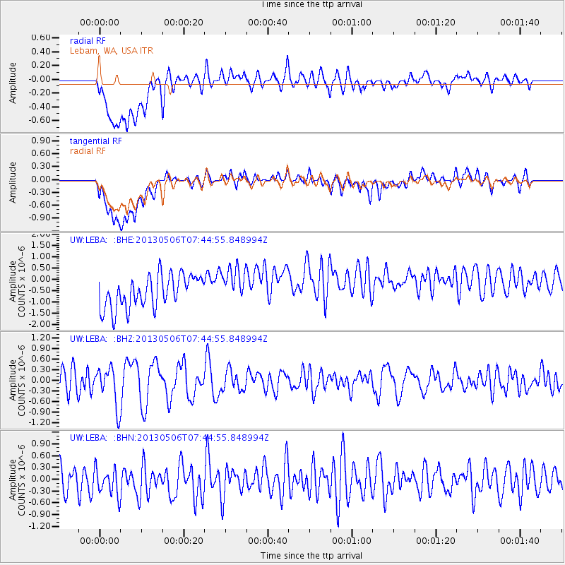
LEBA Lebam, WA, USA - Earthquake Result Viewer
*The percent match for this event was below the threshold and hence no stack was calculated.
| Earthquake location: |
Fiji Islands Region |
| Earthquake latitude/longitude: |
-21.4/-176.3 |
| Earthquake time(UTC): |
2013/05/06 (126) 07:33:03 GMT |
| Earthquake Depth: |
9.9 km |
| Earthquake Magnitude: |
5.5 MW |
| Earthquake Catalog/Contributor: |
NEIC PDE/NEIC PDE-W |
|
| Network: |
UW Pacific Northwest Regional Seismic Network |
| Station: |
LEBA Lebam, WA, USA |
| Lat/Lon: |
46.55 N/123.56 W |
| Elevation: |
73 m |
|
| Distance: |
82.7 deg |
| Az: |
33.627 deg |
| Baz: |
228.402 deg |
| Ray Param: |
$rayparam |
*The percent match for this event was below the threshold and hence was not used in the summary stack. |
|
| Radial Match: |
55.371647 % |
| Radial Bump: |
400 |
| Transverse Match: |
47.877754 % |
| Transverse Bump: |
400 |
| SOD ConfigId: |
512894 |
| Insert Time: |
2013-09-13 23:17:24.928 +0000 |
| GWidth: |
2.5 |
| Max Bumps: |
400 |
| Tol: |
0.001 |
|
Signal To Noise
| Channel | StoN | STA | LTA |
| UW:LEBA: :BHZ:20130506T07:44:55.848994Z | 1.998874 | 5.734237E-7 | 2.8687333E-7 |
| UW:LEBA: :BHN:20130506T07:44:55.848994Z | 1.0919594 | 4.270616E-7 | 3.910966E-7 |
| UW:LEBA: :BHE:20130506T07:44:55.848994Z | 1.143229 | 8.096338E-7 | 7.081991E-7 |
| Arrivals |
| Ps | |
| PpPs | |
| PsPs/PpSs | |


