You are here: Home > Network List > UW - Pacific Northwest Regional Seismic Network Stations List
> Station MRBL Marblemount, WA, USA > Earthquake Result Viewer
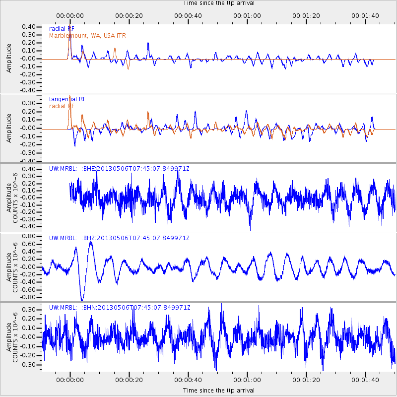
MRBL Marblemount, WA, USA - Earthquake Result Viewer
*The percent match for this event was below the threshold and hence no stack was calculated.
| Earthquake location: |
Fiji Islands Region |
| Earthquake latitude/longitude: |
-21.4/-176.3 |
| Earthquake time(UTC): |
2013/05/06 (126) 07:33:03 GMT |
| Earthquake Depth: |
9.9 km |
| Earthquake Magnitude: |
5.5 MW |
| Earthquake Catalog/Contributor: |
NEIC PDE/NEIC PDE-W |
|
| Network: |
UW Pacific Northwest Regional Seismic Network |
| Station: |
MRBL Marblemount, WA, USA |
| Lat/Lon: |
48.52 N/121.48 W |
| Elevation: |
75 m |
|
| Distance: |
85.0 deg |
| Az: |
33.053 deg |
| Baz: |
229.869 deg |
| Ray Param: |
$rayparam |
*The percent match for this event was below the threshold and hence was not used in the summary stack. |
|
| Radial Match: |
70.932076 % |
| Radial Bump: |
400 |
| Transverse Match: |
68.78437 % |
| Transverse Bump: |
400 |
| SOD ConfigId: |
512894 |
| Insert Time: |
2013-09-13 23:17:35.129 +0000 |
| GWidth: |
2.5 |
| Max Bumps: |
400 |
| Tol: |
0.001 |
|
Signal To Noise
| Channel | StoN | STA | LTA |
| UW:MRBL: :BHZ:20130506T07:45:07.849971Z | 5.2018595 | 4.5264665E-7 | 8.701632E-8 |
| UW:MRBL: :BHN:20130506T07:45:07.849971Z | 1.1858714 | 1.1436026E-7 | 9.643564E-8 |
| UW:MRBL: :BHE:20130506T07:45:07.849971Z | 1.3502772 | 1.541217E-7 | 1.14140775E-7 |
| Arrivals |
| Ps | |
| PpPs | |
| PsPs/PpSs | |


