You are here: Home > Network List > WY - Yellowstone Wyoming Seismic Network Stations List
> Station YHH Holmes Hill, YNP, WY, USA > Earthquake Result Viewer
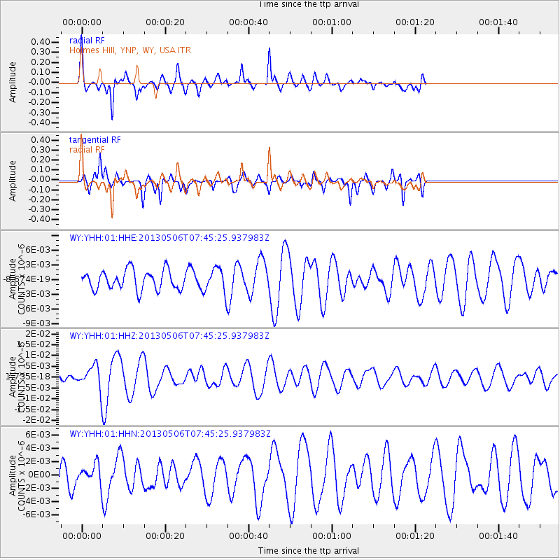
YHH Holmes Hill, YNP, WY, USA - Earthquake Result Viewer
*The percent match for this event was below the threshold and hence no stack was calculated.
| Earthquake location: |
Fiji Islands Region |
| Earthquake latitude/longitude: |
-21.4/-176.3 |
| Earthquake time(UTC): |
2013/05/06 (126) 07:33:03 GMT |
| Earthquake Depth: |
9.9 km |
| Earthquake Magnitude: |
5.5 MW |
| Earthquake Catalog/Contributor: |
NEIC PDE/NEIC PDE-W |
|
| Network: |
WY Yellowstone Wyoming Seismic Network |
| Station: |
YHH Holmes Hill, YNP, WY, USA |
| Lat/Lon: |
44.79 N/110.85 W |
| Elevation: |
2717 m |
|
| Distance: |
88.8 deg |
| Az: |
40.378 deg |
| Baz: |
237.988 deg |
| Ray Param: |
$rayparam |
*The percent match for this event was below the threshold and hence was not used in the summary stack. |
|
| Radial Match: |
73.69588 % |
| Radial Bump: |
353 |
| Transverse Match: |
81.88756 % |
| Transverse Bump: |
314 |
| SOD ConfigId: |
512894 |
| Insert Time: |
2013-09-13 23:18:17.936 +0000 |
| GWidth: |
2.5 |
| Max Bumps: |
400 |
| Tol: |
0.001 |
|
Signal To Noise
| Channel | StoN | STA | LTA |
| WY:YHH:01:HHZ:20130506T07:45:25.937983Z | 3.8149626 | 5.3886664E-9 | 1.4125084E-9 |
| WY:YHH:01:HHN:20130506T07:45:25.937983Z | 0.9188503 | 1.4113299E-9 | 1.5359738E-9 |
| WY:YHH:01:HHE:20130506T07:45:25.937983Z | 1.3005209 | 2.536531E-9 | 1.950396E-9 |
| Arrivals |
| Ps | |
| PpPs | |
| PsPs/PpSs | |


