You are here: Home > Network List > TA - USArray Transportable Network (new EarthScope stations) Stations List
> Station N02D Trinity Center, CA, USA > Earthquake Result Viewer
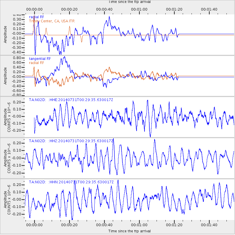
N02D Trinity Center, CA, USA - Earthquake Result Viewer
*The percent match for this event was below the threshold and hence no stack was calculated.
| Earthquake location: |
South Of Fiji Islands |
| Earthquake latitude/longitude: |
-23.5/-176.4 |
| Earthquake time(UTC): |
2014/07/31 (212) 00:17:54 GMT |
| Earthquake Depth: |
38 km |
| Earthquake Magnitude: |
5.4 MW, 5.3 mb, 4.9 MS |
| Earthquake Catalog/Contributor: |
ISC/ISC |
|
| Network: |
TA USArray Transportable Network (new EarthScope stations) |
| Station: |
N02D Trinity Center, CA, USA |
| Lat/Lon: |
40.97 N/122.71 W |
| Elevation: |
937 m |
|
| Distance: |
81.2 deg |
| Az: |
38.123 deg |
| Baz: |
228.461 deg |
| Ray Param: |
$rayparam |
*The percent match for this event was below the threshold and hence was not used in the summary stack. |
|
| Radial Match: |
50.73564 % |
| Radial Bump: |
400 |
| Transverse Match: |
36.42464 % |
| Transverse Bump: |
400 |
| SOD ConfigId: |
3390531 |
| Insert Time: |
2019-04-13 02:52:31.577 +0000 |
| GWidth: |
2.5 |
| Max Bumps: |
400 |
| Tol: |
0.001 |
|
Signal To Noise
| Channel | StoN | STA | LTA |
| TA:N02D: :HHZ:20140731T00:29:35.630017Z | 0.84810203 | 7.9251265E-8 | 9.3445436E-8 |
| TA:N02D: :HHN:20140731T00:29:35.630017Z | 1.1578779 | 1.905419E-7 | 1.645613E-7 |
| TA:N02D: :HHE:20140731T00:29:35.630017Z | 0.731544 | 6.958866E-8 | 9.5125735E-8 |
| Arrivals |
| Ps | |
| PpPs | |
| PsPs/PpSs | |


