You are here: Home > Network List > TA - USArray Transportable Network (new EarthScope stations) Stations List
> Station O03E Paynes Creek, CA, USA > Earthquake Result Viewer
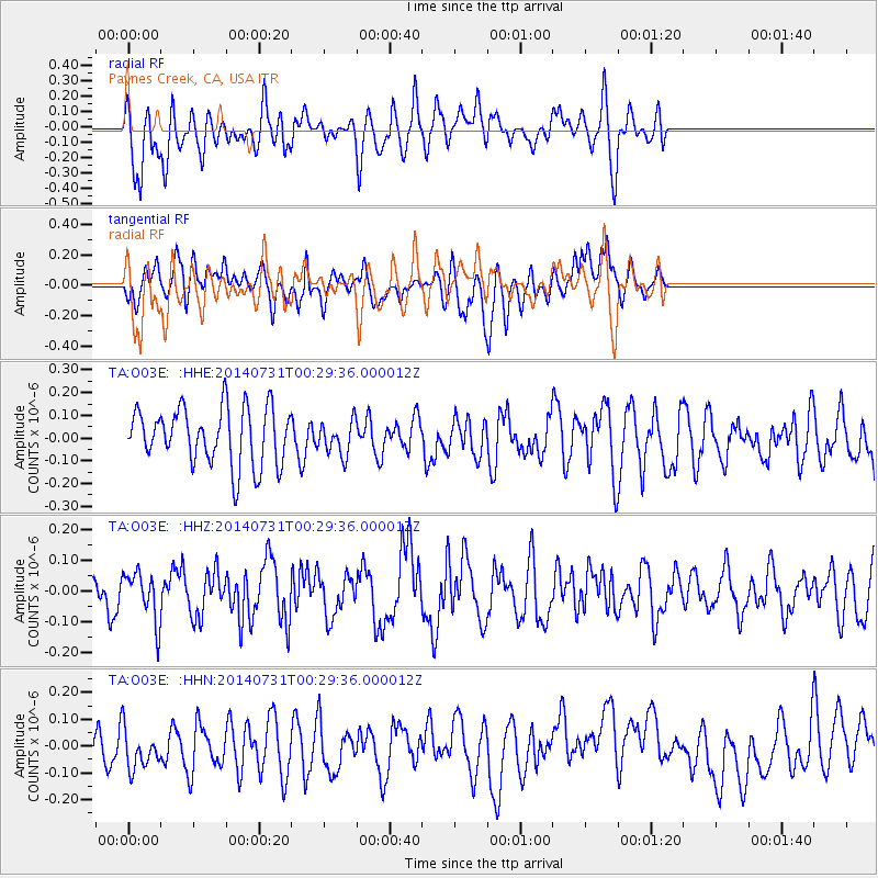
O03E Paynes Creek, CA, USA - Earthquake Result Viewer
*The percent match for this event was below the threshold and hence no stack was calculated.
| Earthquake location: |
South Of Fiji Islands |
| Earthquake latitude/longitude: |
-23.5/-176.4 |
| Earthquake time(UTC): |
2014/07/31 (212) 00:17:54 GMT |
| Earthquake Depth: |
38 km |
| Earthquake Magnitude: |
5.4 MW, 5.3 mb, 4.9 MS |
| Earthquake Catalog/Contributor: |
ISC/ISC |
|
| Network: |
TA USArray Transportable Network (new EarthScope stations) |
| Station: |
O03E Paynes Creek, CA, USA |
| Lat/Lon: |
40.29 N/121.80 W |
| Elevation: |
967 m |
|
| Distance: |
81.3 deg |
| Az: |
39.097 deg |
| Baz: |
229.195 deg |
| Ray Param: |
$rayparam |
*The percent match for this event was below the threshold and hence was not used in the summary stack. |
|
| Radial Match: |
59.3949 % |
| Radial Bump: |
400 |
| Transverse Match: |
46.365227 % |
| Transverse Bump: |
400 |
| SOD ConfigId: |
3390531 |
| Insert Time: |
2019-04-13 02:52:32.946 +0000 |
| GWidth: |
2.5 |
| Max Bumps: |
400 |
| Tol: |
0.001 |
|
Signal To Noise
| Channel | StoN | STA | LTA |
| TA:O03E: :HHZ:20140731T00:29:36.000012Z | 0.8547797 | 7.9143284E-8 | 9.25891E-8 |
| TA:O03E: :HHN:20140731T00:29:36.000012Z | 0.78176177 | 8.933768E-8 | 1.14277384E-7 |
| TA:O03E: :HHE:20140731T00:29:36.000012Z | 0.5942232 | 7.450547E-8 | 1.2538298E-7 |
| Arrivals |
| Ps | |
| PpPs | |
| PsPs/PpSs | |


