You are here: Home > Network List > PS - Pacific21 Stations List
> Station PSI Parapat, Indonesia > Earthquake Result Viewer
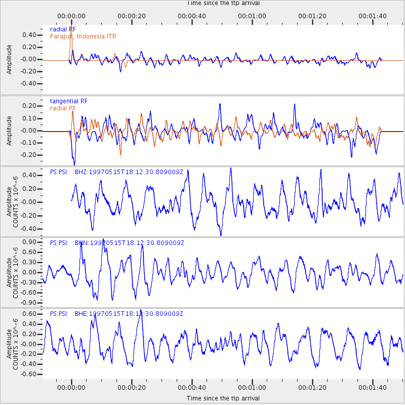
PSI Parapat, Indonesia - Earthquake Result Viewer
*The percent match for this event was below the threshold and hence no stack was calculated.
| Earthquake location: |
Southeast Of Loyalty Islands |
| Earthquake latitude/longitude: |
-21.6/169.9 |
| Earthquake time(UTC): |
1997/05/15 (135) 18:01:33 GMT |
| Earthquake Depth: |
33 km |
| Earthquake Magnitude: |
5.3 MB, 5.6 MS, 6.0 UNKNOWN, 5.9 MW |
| Earthquake Catalog/Contributor: |
WHDF/NEIC |
|
| Network: |
PS Pacific21 |
| Station: |
PSI Parapat, Indonesia |
| Lat/Lon: |
2.69 N/98.92 E |
| Elevation: |
987 m |
|
| Distance: |
73.4 deg |
| Az: |
279.788 deg |
| Baz: |
113.379 deg |
| Ray Param: |
$rayparam |
*The percent match for this event was below the threshold and hence was not used in the summary stack. |
|
| Radial Match: |
49.102734 % |
| Radial Bump: |
400 |
| Transverse Match: |
58.58221 % |
| Transverse Bump: |
400 |
| SOD ConfigId: |
4480 |
| Insert Time: |
2010-02-27 03:26:49.664 +0000 |
| GWidth: |
2.5 |
| Max Bumps: |
400 |
| Tol: |
0.001 |
|
Signal To Noise
| Channel | StoN | STA | LTA |
| PS:PSI: :BHN:19970515T18:12:30.809009Z | 2.9647577 | 3.5711517E-7 | 1.2045341E-7 |
| PS:PSI: :BHE:19970515T18:12:30.809009Z | 0.86252064 | 1.4891462E-7 | 1.726505E-7 |
| PS:PSI: :BHZ:19970515T18:12:30.809009Z | 0.54018307 | 9.076373E-8 | 1.68024E-7 |
| Arrivals |
| Ps | |
| PpPs | |
| PsPs/PpSs | |


