You are here: Home > Network List > UU - University of Utah Regional Network Stations List
> Station KNB Kanab, UT, USA > Earthquake Result Viewer
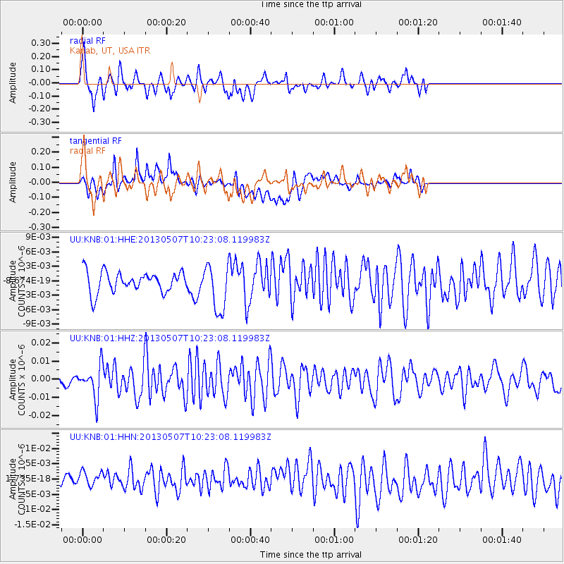
KNB Kanab, UT, USA - Earthquake Result Viewer
*The percent match for this event was below the threshold and hence no stack was calculated.
| Earthquake location: |
South Of Fiji Islands |
| Earthquake latitude/longitude: |
-19.6/175.1 |
| Earthquake time(UTC): |
2013/05/07 (127) 10:10:48 GMT |
| Earthquake Depth: |
11 km |
| Earthquake Magnitude: |
5.6 MB, 5.7 MS, 6.0 MW, 5.9 MW |
| Earthquake Catalog/Contributor: |
WHDF/NEIC |
|
| Network: |
UU University of Utah Regional Network |
| Station: |
KNB Kanab, UT, USA |
| Lat/Lon: |
37.02 N/112.82 W |
| Elevation: |
1715 m |
|
| Distance: |
88.2 deg |
| Az: |
49.654 deg |
| Baz: |
243.843 deg |
| Ray Param: |
$rayparam |
*The percent match for this event was below the threshold and hence was not used in the summary stack. |
|
| Radial Match: |
70.800995 % |
| Radial Bump: |
400 |
| Transverse Match: |
57.409683 % |
| Transverse Bump: |
400 |
| SOD ConfigId: |
512894 |
| Insert Time: |
2013-09-13 23:35:49.136 +0000 |
| GWidth: |
2.5 |
| Max Bumps: |
400 |
| Tol: |
0.001 |
|
Signal To Noise
| Channel | StoN | STA | LTA |
| UU:KNB:01:HHZ:20130507T10:23:08.119983Z | 3.7249243 | 9.124342E-9 | 2.4495375E-9 |
| UU:KNB:01:HHN:20130507T10:23:08.119983Z | 1.2694734 | 3.3992562E-9 | 2.6776898E-9 |
| UU:KNB:01:HHE:20130507T10:23:08.119983Z | 2.3306394 | 4.9788618E-9 | 2.1362645E-9 |
| Arrivals |
| Ps | |
| PpPs | |
| PsPs/PpSs | |


