You are here: Home > Network List > US - United States National Seismic Network Stations List
> Station ACSO Alum Creek State Park, Ohio, USA > Earthquake Result Viewer
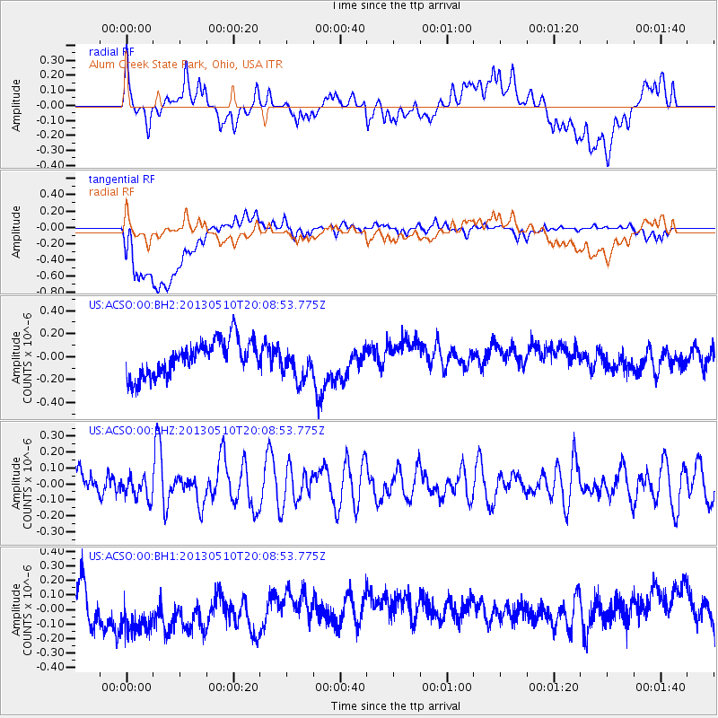
ACSO Alum Creek State Park, Ohio, USA - Earthquake Result Viewer
*The percent match for this event was below the threshold and hence no stack was calculated.
| Earthquake location: |
Southern Mid-Atlantic Ridge |
| Earthquake latitude/longitude: |
-29.0/-13.2 |
| Earthquake time(UTC): |
2013/05/10 (130) 19:56:04 GMT |
| Earthquake Depth: |
3.9 km |
| Earthquake Magnitude: |
5.5 MB, 5.6 MS, 5.7 MW, 5.7 MW |
| Earthquake Catalog/Contributor: |
WHDF/NEIC |
|
| Network: |
US United States National Seismic Network |
| Station: |
ACSO Alum Creek State Park, Ohio, USA |
| Lat/Lon: |
40.23 N/82.98 W |
| Elevation: |
288 m |
|
| Distance: |
94.5 deg |
| Az: |
313.907 deg |
| Baz: |
124.461 deg |
| Ray Param: |
$rayparam |
*The percent match for this event was below the threshold and hence was not used in the summary stack. |
|
| Radial Match: |
39.986362 % |
| Radial Bump: |
400 |
| Transverse Match: |
28.631084 % |
| Transverse Bump: |
400 |
| SOD ConfigId: |
512894 |
| Insert Time: |
2013-09-13 23:58:30.185 +0000 |
| GWidth: |
2.5 |
| Max Bumps: |
400 |
| Tol: |
0.001 |
|
Signal To Noise
| Channel | StoN | STA | LTA |
| US:ACSO:00:BHZ:20130510T20:08:53.775Z | 1.090877 | 7.068814E-8 | 6.479936E-8 |
| US:ACSO:00:BH1:20130510T20:08:53.775Z | 2.1045322 | 1.9901755E-7 | 9.456617E-8 |
| US:ACSO:00:BH2:20130510T20:08:53.775Z | 0.95237345 | 1.4385988E-7 | 1.5105407E-7 |
| Arrivals |
| Ps | |
| PpPs | |
| PsPs/PpSs | |


