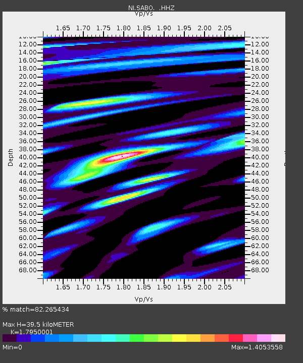
SABO Mt. Sabotino - Earthquake Result Viewer

Earthquake location: Southern Iran
Earthquake latitude/longitude: 26.6/57.8
Earthquake time(UTC): 2013/05/11 (131) 02:08:08 GMT
Earthquake Depth: 15 km
Earthquake Magnitude: 5.9 MB, 6.2 MS, 6.1 MW, 6.1 MW
Earthquake Catalog/Contributor: WHDF/NEIC
Network: NI North-East Italy Broadband Network
Station: SABO Mt. Sabotino
Lat/Lon: 45.99 N/13.63 E
Elevation: 621 m
Distance: 39.9 deg
Az: 310.829 deg
Baz: 103.585 deg
Ray Param: 0.0746889
Estimated Moho Depth: 39.5 km
Estimated Crust Vp/Vs: 1.80
Assumed Crust Vp: 6.207 km/s
Estimated Crust Vs: 3.458 km/s
Estimated Crust Poisson's Ratio: 0.27
Radial Match: 82.265434 %
Radial Bump: 400
Transverse Match: 67.046814 %
Transverse Bump: 400
SOD ConfigId: 512894
Insert Time: 2013-09-14 00:10:17.569 +0000
GWidth: 2.5
Max Bumps: 400
Tol: 0.001

Signal To Noise

ChannelStoNSTALTA
NI:SABO: :HHZ:20130511T02:15:10.988007Z3.29911733.7182068E-71.1270308E-7
NI:SABO: :HHN:20130511T02:15:10.988007Z1.23584221.4055219E-71.1372989E-7
NI:SABO: :HHE:20130511T02:15:10.988007Z1.75370031.5750764E-78.981446E-8
Arrivals
Ps5.4 SECOND
PpPs17 SECOND
PsPs/PpSs22 SECOND