You are here: Home > Network List > PS - Pacific21 Stations List
> Station PSI Parapat, Indonesia > Earthquake Result Viewer
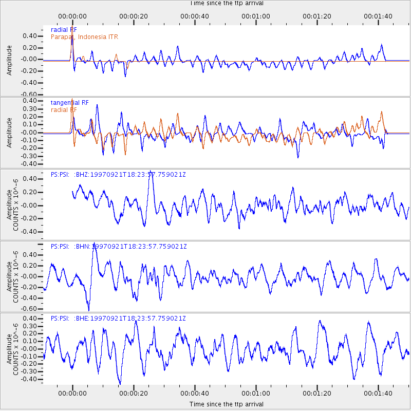
PSI Parapat, Indonesia - Earthquake Result Viewer
*The percent match for this event was below the threshold and hence no stack was calculated.
| Earthquake location: |
Lake Tanganyika Region |
| Earthquake latitude/longitude: |
-7.4/30.4 |
| Earthquake time(UTC): |
1997/09/21 (264) 18:13:22 GMT |
| Earthquake Depth: |
10 km |
| Earthquake Magnitude: |
5.7 MB, 6.2 MS, 6.0 UNKNOWN, 5.9 MW |
| Earthquake Catalog/Contributor: |
WHDF/NEIC |
|
| Network: |
PS Pacific21 |
| Station: |
PSI Parapat, Indonesia |
| Lat/Lon: |
2.69 N/98.92 E |
| Elevation: |
987 m |
|
| Distance: |
69.1 deg |
| Az: |
84.301 deg |
| Baz: |
261.131 deg |
| Ray Param: |
$rayparam |
*The percent match for this event was below the threshold and hence was not used in the summary stack. |
|
| Radial Match: |
44.826004 % |
| Radial Bump: |
400 |
| Transverse Match: |
60.75841 % |
| Transverse Bump: |
400 |
| SOD ConfigId: |
4480 |
| Insert Time: |
2010-02-27 03:27:37.717 +0000 |
| GWidth: |
2.5 |
| Max Bumps: |
400 |
| Tol: |
0.001 |
|
Signal To Noise
| Channel | StoN | STA | LTA |
| PS:PSI: :BHN:19970921T18:23:57.759021Z | 1.5685799 | 1.7929403E-7 | 1.1430341E-7 |
| PS:PSI: :BHE:19970921T18:23:57.759021Z | 1.4820094 | 1.3883879E-7 | 9.36828E-8 |
| PS:PSI: :BHZ:19970921T18:23:57.759021Z | 1.2127775 | 1.8127879E-7 | 1.4947408E-7 |
| Arrivals |
| Ps | |
| PpPs | |
| PsPs/PpSs | |


