You are here: Home > Network List > TA - USArray Transportable Network (new EarthScope stations) Stations List
> Station K39A Oelwein, IA, USA > Earthquake Result Viewer
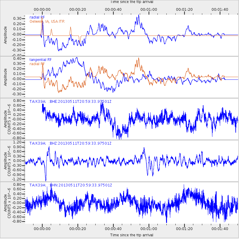
K39A Oelwein, IA, USA - Earthquake Result Viewer
*The percent match for this event was below the threshold and hence no stack was calculated.
| Earthquake location: |
Tonga Islands |
| Earthquake latitude/longitude: |
-18.0/-175.1 |
| Earthquake time(UTC): |
2013/05/11 (131) 20:46:57 GMT |
| Earthquake Depth: |
213 km |
| Earthquake Magnitude: |
5.8 MB, 6.4 MW, 6.4 MW |
| Earthquake Catalog/Contributor: |
WHDF/NEIC |
|
| Network: |
TA USArray Transportable Network (new EarthScope stations) |
| Station: |
K39A Oelwein, IA, USA |
| Lat/Lon: |
42.71 N/91.89 W |
| Elevation: |
332 m |
|
| Distance: |
97.1 deg |
| Az: |
47.535 deg |
| Baz: |
252.285 deg |
| Ray Param: |
$rayparam |
*The percent match for this event was below the threshold and hence was not used in the summary stack. |
|
| Radial Match: |
32.388187 % |
| Radial Bump: |
400 |
| Transverse Match: |
47.761944 % |
| Transverse Bump: |
400 |
| SOD ConfigId: |
512894 |
| Insert Time: |
2013-09-14 00:45:03.458 +0000 |
| GWidth: |
2.5 |
| Max Bumps: |
400 |
| Tol: |
0.001 |
|
Signal To Noise
| Channel | StoN | STA | LTA |
| TA:K39A: :BHZ:20130511T20:59:33.97501Z | 4.748878 | 5.1685777E-7 | 1.08837874E-7 |
| TA:K39A: :BHN:20130511T20:59:33.97501Z | 1.3400074 | 3.1495173E-7 | 2.350373E-7 |
| TA:K39A: :BHE:20130511T20:59:33.97501Z | 1.5840348 | 2.843444E-7 | 1.795064E-7 |
| Arrivals |
| Ps | |
| PpPs | |
| PsPs/PpSs | |


