You are here: Home > Network List > TA - USArray Transportable Network (new EarthScope stations) Stations List
> Station M53A WI Miller and Sons, Farmdale, OH, USA > Earthquake Result Viewer
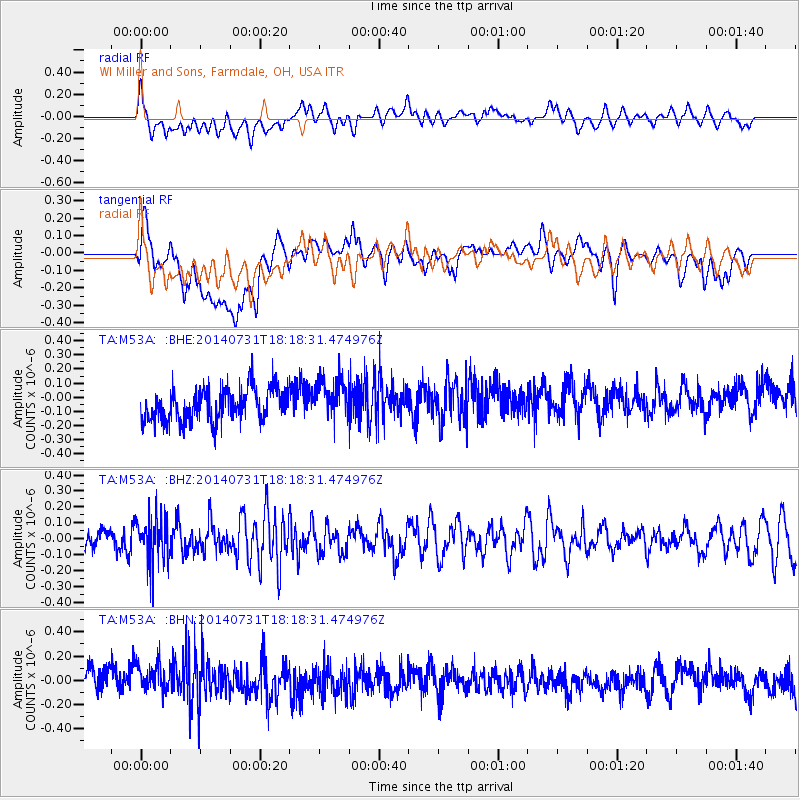
M53A WI Miller and Sons, Farmdale, OH, USA - Earthquake Result Viewer
*The percent match for this event was below the threshold and hence no stack was calculated.
| Earthquake location: |
Southern Peru |
| Earthquake latitude/longitude: |
-16.5/-71.2 |
| Earthquake time(UTC): |
2014/07/31 (212) 18:09:19 GMT |
| Earthquake Depth: |
116 km |
| Earthquake Magnitude: |
4.9 MW, 3.6 ms1mx, 3.8 Ms1, 3.8 MS, 5.0 mbtmp, 4.6 mb1mx, 4.7 mb1, 4.6 mb |
| Earthquake Catalog/Contributor: |
ISC/ISC |
|
| Network: |
TA USArray Transportable Network (new EarthScope stations) |
| Station: |
M53A WI Miller and Sons, Farmdale, OH, USA |
| Lat/Lon: |
41.44 N/80.68 W |
| Elevation: |
334 m |
|
| Distance: |
58.3 deg |
| Az: |
351.644 deg |
| Baz: |
169.311 deg |
| Ray Param: |
$rayparam |
*The percent match for this event was below the threshold and hence was not used in the summary stack. |
|
| Radial Match: |
38.06243 % |
| Radial Bump: |
400 |
| Transverse Match: |
50.34932 % |
| Transverse Bump: |
400 |
| SOD ConfigId: |
3390531 |
| Insert Time: |
2019-04-13 03:07:13.100 +0000 |
| GWidth: |
2.5 |
| Max Bumps: |
400 |
| Tol: |
0.001 |
|
Signal To Noise
| Channel | StoN | STA | LTA |
| TA:M53A: :BHZ:20140731T18:18:31.474976Z | 1.5197783 | 1.5144008E-7 | 9.964616E-8 |
| TA:M53A: :BHN:20140731T18:18:31.474976Z | 1.1257831 | 1.387043E-7 | 1.2320695E-7 |
| TA:M53A: :BHE:20140731T18:18:31.474976Z | 1.2407525 | 1.4183414E-7 | 1.1431301E-7 |
| Arrivals |
| Ps | |
| PpPs | |
| PsPs/PpSs | |


