You are here: Home > Network List > US - United States National Seismic Network Stations List
> Station CBKS Cedar Bluff, Kansas, USA > Earthquake Result Viewer
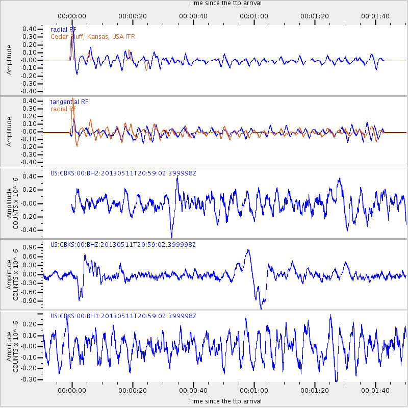
CBKS Cedar Bluff, Kansas, USA - Earthquake Result Viewer
*The percent match for this event was below the threshold and hence no stack was calculated.
| Earthquake location: |
Tonga Islands |
| Earthquake latitude/longitude: |
-18.0/-175.1 |
| Earthquake time(UTC): |
2013/05/11 (131) 20:46:57 GMT |
| Earthquake Depth: |
213 km |
| Earthquake Magnitude: |
5.8 MB, 6.4 MW, 6.4 MW |
| Earthquake Catalog/Contributor: |
WHDF/NEIC |
|
| Network: |
US United States National Seismic Network |
| Station: |
CBKS Cedar Bluff, Kansas, USA |
| Lat/Lon: |
38.81 N/99.74 W |
| Elevation: |
677 m |
|
| Distance: |
90.2 deg |
| Az: |
49.105 deg |
| Baz: |
247.072 deg |
| Ray Param: |
$rayparam |
*The percent match for this event was below the threshold and hence was not used in the summary stack. |
|
| Radial Match: |
68.82146 % |
| Radial Bump: |
400 |
| Transverse Match: |
44.531933 % |
| Transverse Bump: |
400 |
| SOD ConfigId: |
512894 |
| Insert Time: |
2013-09-14 00:46:15.178 +0000 |
| GWidth: |
2.5 |
| Max Bumps: |
400 |
| Tol: |
0.001 |
|
Signal To Noise
| Channel | StoN | STA | LTA |
| US:CBKS:00:BHZ:20130511T20:59:02.399998Z | 6.124475 | 4.158E-7 | 6.7891534E-8 |
| US:CBKS:00:BH1:20130511T20:59:02.399998Z | 1.3065389 | 9.45857E-8 | 7.239409E-8 |
| US:CBKS:00:BH2:20130511T20:59:02.399998Z | 2.3843462 | 2.1922804E-7 | 9.194472E-8 |
| Arrivals |
| Ps | |
| PpPs | |
| PsPs/PpSs | |


