You are here: Home > Network List > PS - Pacific21 Stations List
> Station PSI Parapat, Indonesia > Earthquake Result Viewer
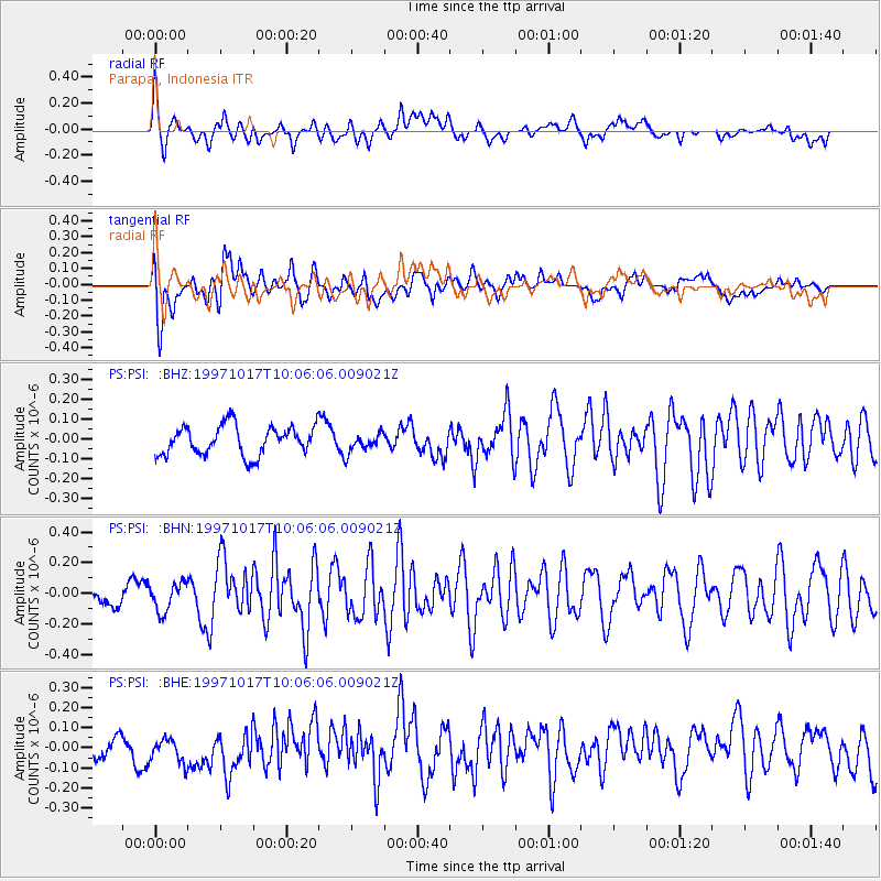
PSI Parapat, Indonesia - Earthquake Result Viewer
*The percent match for this event was below the threshold and hence no stack was calculated.
| Earthquake location: |
West Of Macquarie Island |
| Earthquake latitude/longitude: |
-57.5/148.0 |
| Earthquake time(UTC): |
1997/10/17 (290) 09:55:15 GMT |
| Earthquake Depth: |
10 km |
| Earthquake Magnitude: |
5.2 MB, 5.9 MS, 6.2 UNKNOWN, 6.0 MW |
| Earthquake Catalog/Contributor: |
WHDF/NEIC |
|
| Network: |
PS Pacific21 |
| Station: |
PSI Parapat, Indonesia |
| Lat/Lon: |
2.69 N/98.92 E |
| Elevation: |
987 m |
|
| Distance: |
71.7 deg |
| Az: |
307.388 deg |
| Baz: |
154.598 deg |
| Ray Param: |
$rayparam |
*The percent match for this event was below the threshold and hence was not used in the summary stack. |
|
| Radial Match: |
76.97928 % |
| Radial Bump: |
400 |
| Transverse Match: |
75.68208 % |
| Transverse Bump: |
400 |
| SOD ConfigId: |
4480 |
| Insert Time: |
2010-02-27 03:28:02.034 +0000 |
| GWidth: |
2.5 |
| Max Bumps: |
400 |
| Tol: |
0.001 |
|
Signal To Noise
| Channel | StoN | STA | LTA |
| PS:PSI: :BHN:19971017T10:06:06.009021Z | 1.116815 | 9.402284E-8 | 8.418838E-8 |
| PS:PSI: :BHE:19971017T10:06:06.009021Z | 0.9823091 | 7.78552E-8 | 7.9257326E-8 |
| PS:PSI: :BHZ:19971017T10:06:06.009021Z | 0.6427171 | 4.7039723E-8 | 7.318885E-8 |
| Arrivals |
| Ps | |
| PpPs | |
| PsPs/PpSs | |


