You are here: Home > Network List > TA - USArray Transportable Network (new EarthScope stations) Stations List
> Station P59A Jarrettsville, MD, USA > Earthquake Result Viewer
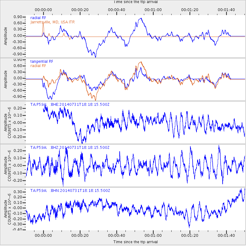
P59A Jarrettsville, MD, USA - Earthquake Result Viewer
*The percent match for this event was below the threshold and hence no stack was calculated.
| Earthquake location: |
Southern Peru |
| Earthquake latitude/longitude: |
-16.5/-71.2 |
| Earthquake time(UTC): |
2014/07/31 (212) 18:09:19 GMT |
| Earthquake Depth: |
116 km |
| Earthquake Magnitude: |
4.9 MW, 3.6 ms1mx, 3.8 Ms1, 3.8 MS, 5.0 mbtmp, 4.6 mb1mx, 4.7 mb1, 4.6 mb |
| Earthquake Catalog/Contributor: |
ISC/ISC |
|
| Network: |
TA USArray Transportable Network (new EarthScope stations) |
| Station: |
P59A Jarrettsville, MD, USA |
| Lat/Lon: |
39.61 N/76.43 W |
| Elevation: |
157 m |
|
| Distance: |
56.0 deg |
| Az: |
355.136 deg |
| Baz: |
173.955 deg |
| Ray Param: |
$rayparam |
*The percent match for this event was below the threshold and hence was not used in the summary stack. |
|
| Radial Match: |
16.543234 % |
| Radial Bump: |
400 |
| Transverse Match: |
25.486694 % |
| Transverse Bump: |
400 |
| SOD ConfigId: |
3390531 |
| Insert Time: |
2019-04-13 03:07:27.009 +0000 |
| GWidth: |
2.5 |
| Max Bumps: |
400 |
| Tol: |
0.001 |
|
Signal To Noise
| Channel | StoN | STA | LTA |
| TA:P59A: :BHZ:20140731T18:18:15.500Z | 0.9716149 | 7.66295E-8 | 7.8868176E-8 |
| TA:P59A: :BHN:20140731T18:18:15.500Z | 1.3585789 | 2.204888E-7 | 1.622937E-7 |
| TA:P59A: :BHE:20140731T18:18:15.500Z | 0.4782209 | 7.193894E-8 | 1.5043037E-7 |
| Arrivals |
| Ps | |
| PpPs | |
| PsPs/PpSs | |


