You are here: Home > Network List > PS - Pacific21 Stations List
> Station PSI Parapat, Indonesia > Earthquake Result Viewer
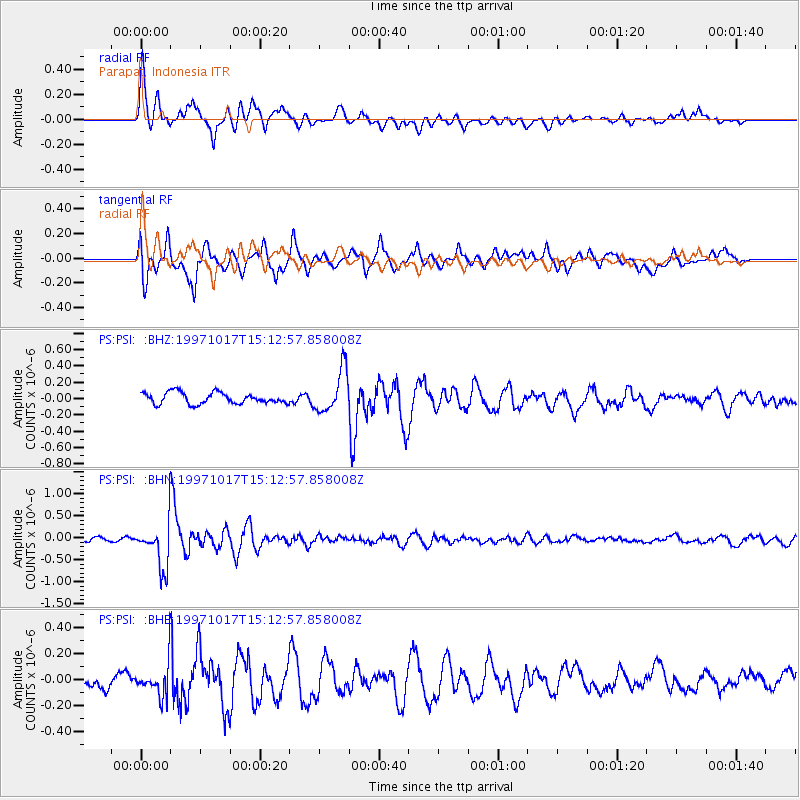
PSI Parapat, Indonesia - Earthquake Result Viewer
*The percent match for this event was below the threshold and hence no stack was calculated.
| Earthquake location: |
Fiji Islands Region |
| Earthquake latitude/longitude: |
-20.9/-178.8 |
| Earthquake time(UTC): |
1997/10/17 (290) 15:02:00 GMT |
| Earthquake Depth: |
579 km |
| Earthquake Magnitude: |
5.3 MB, 6.0 UNKNOWN, 6.0 MW |
| Earthquake Catalog/Contributor: |
WHDF/NEIC |
|
| Network: |
PS Pacific21 |
| Station: |
PSI Parapat, Indonesia |
| Lat/Lon: |
2.69 N/98.92 E |
| Elevation: |
987 m |
|
| Distance: |
83.7 deg |
| Az: |
275.281 deg |
| Baz: |
111.232 deg |
| Ray Param: |
$rayparam |
*The percent match for this event was below the threshold and hence was not used in the summary stack. |
|
| Radial Match: |
76.18069 % |
| Radial Bump: |
400 |
| Transverse Match: |
81.03269 % |
| Transverse Bump: |
400 |
| SOD ConfigId: |
4480 |
| Insert Time: |
2010-02-27 03:28:02.928 +0000 |
| GWidth: |
2.5 |
| Max Bumps: |
400 |
| Tol: |
0.001 |
|
Signal To Noise
| Channel | StoN | STA | LTA |
| PS:PSI: :BHN:19971017T15:12:57.858008Z | 10.705481 | 5.297922E-7 | 4.9487944E-8 |
| PS:PSI: :BHE:19971017T15:12:57.858008Z | 2.2216594 | 1.3077882E-7 | 5.8865375E-8 |
| PS:PSI: :BHZ:19971017T15:12:57.858008Z | 3.818437 | 2.6076648E-7 | 6.829142E-8 |
| Arrivals |
| Ps | |
| PpPs | |
| PsPs/PpSs | |


