You are here: Home > Network List > US - United States National Seismic Network Stations List
> Station SCIA State Center, Iowa, USA > Earthquake Result Viewer
SCIA State Center, Iowa, USA - Earthquake Result Viewer
*The percent match for this event was below the threshold and hence no stack was calculated.
| Earthquake location: |
Tonga Islands |
| Earthquake latitude/longitude: |
-18.0/-175.1 |
| Earthquake time(UTC): |
2013/05/11 (131) 20:46:57 GMT |
| Earthquake Depth: |
213 km |
| Earthquake Magnitude: |
5.8 MB, 6.4 MW, 6.4 MW |
| Earthquake Catalog/Contributor: |
WHDF/NEIC |
|
| Network: |
US United States National Seismic Network |
| Station: |
SCIA State Center, Iowa, USA |
| Lat/Lon: |
41.91 N/93.22 W |
| Elevation: |
312 m |
|
| Distance: |
96.0 deg |
| Az: |
47.988 deg |
| Baz: |
251.343 deg |
| Ray Param: |
$rayparam |
*The percent match for this event was below the threshold and hence was not used in the summary stack. |
|
| Radial Match: |
35.371674 % |
| Radial Bump: |
400 |
| Transverse Match: |
43.884876 % |
| Transverse Bump: |
400 |
| SOD ConfigId: |
512894 |
| Insert Time: |
2013-09-14 00:47:27.480 +0000 |
| GWidth: |
2.5 |
| Max Bumps: |
400 |
| Tol: |
0.001 |
|
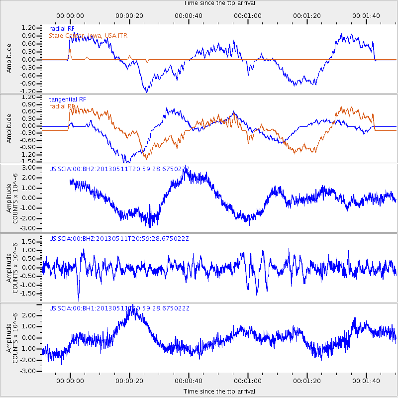
Signal To Noise
| Channel | StoN | STA | LTA |
| US:SCIA:00:BHZ:20130511T20:59:28.675022Z | 2.5493472 | 6.6063285E-7 | 2.5913803E-7 |
| US:SCIA:00:BH1:20130511T20:59:28.675022Z | 0.63185775 | 5.8393726E-7 | 9.2415934E-7 |
| US:SCIA:00:BH2:20130511T20:59:28.675022Z | 0.88969326 | 1.0738984E-6 | 1.2070434E-6 |
| Arrivals |
| Ps | |
| PpPs | |
| PsPs/PpSs | |


