You are here: Home > Network List > PS - Pacific21 Stations List
> Station PSI Parapat, Indonesia > Earthquake Result Viewer
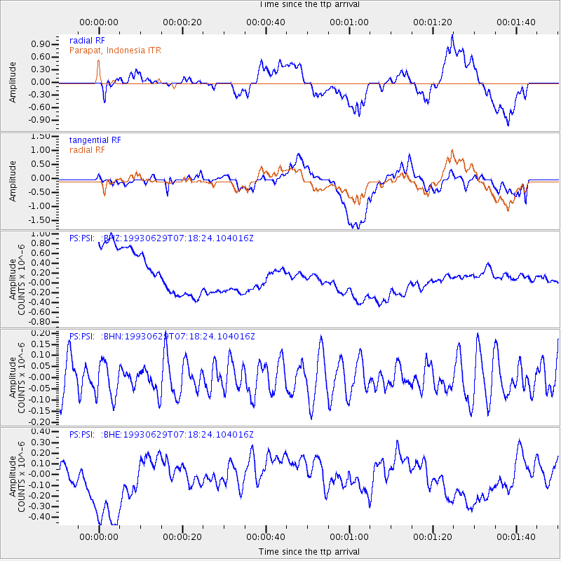
PSI Parapat, Indonesia - Earthquake Result Viewer
*The percent match for this event was below the threshold and hence no stack was calculated.
| Earthquake location: |
West Of Macquarie Island |
| Earthquake latitude/longitude: |
-60.4/152.7 |
| Earthquake time(UTC): |
1993/06/29 (180) 07:07:11 GMT |
| Earthquake Depth: |
10 km |
| Earthquake Magnitude: |
5.8 MS, 4.9 MB |
| Earthquake Catalog/Contributor: |
WHDF/NEIC |
|
| Network: |
PS Pacific21 |
| Station: |
PSI Parapat, Indonesia |
| Lat/Lon: |
2.69 N/98.92 E |
| Elevation: |
987 m |
|
| Distance: |
75.4 deg |
| Az: |
303.626 deg |
| Baz: |
155.564 deg |
| Ray Param: |
$rayparam |
*The percent match for this event was below the threshold and hence was not used in the summary stack. |
|
| Radial Match: |
34.886642 % |
| Radial Bump: |
400 |
| Transverse Match: |
12.387717 % |
| Transverse Bump: |
400 |
| SOD ConfigId: |
4480 |
| Insert Time: |
2010-02-27 03:28:28.107 +0000 |
| GWidth: |
2.5 |
| Max Bumps: |
400 |
| Tol: |
0.001 |
|
Signal To Noise
| Channel | StoN | STA | LTA |
| PS:PSI: :BHN:19930629T07:18:24.104016Z | 1.0652266 | 8.0055905E-8 | 7.515388E-8 |
| PS:PSI: :BHE:19930629T07:18:24.104016Z | 1.5674325 | 6.0926595E-7 | 3.8870314E-7 |
| PS:PSI: :BHZ:19930629T07:18:24.104016Z | 1.0023035 | 4.458008E-7 | 4.4477625E-7 |
| Arrivals |
| Ps | |
| PpPs | |
| PsPs/PpSs | |


