You are here: Home > Network List > CN - Canadian National Seismograph Network Stations List
> Station INK INUVIK, NT > Earthquake Result Viewer
INK INUVIK, NT - Earthquake Result Viewer
*The percent match for this event was below the threshold and hence no stack was calculated.
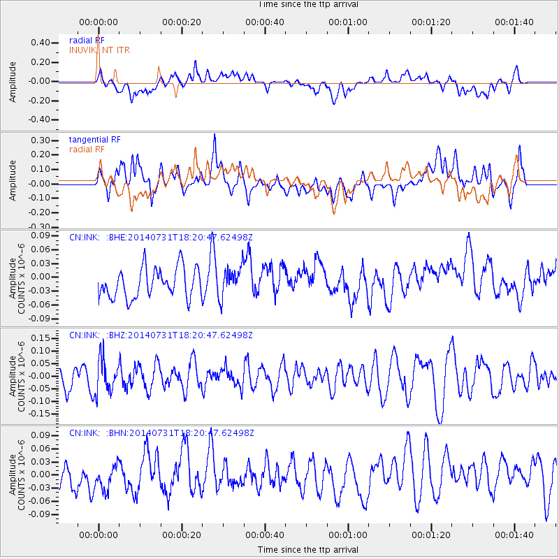
| Earthquake location: |
Mariana Islands |
| Earthquake latitude/longitude: |
14.9/145.5 |
| Earthquake time(UTC): |
2014/07/31 (212) 18:10:02 GMT |
| Earthquake Depth: |
123 km |
| Earthquake Magnitude: |
5.0 mb |
| Earthquake Catalog/Contributor: |
ISC/ISC |
|
| Network: |
CN Canadian National Seismograph Network |
| Station: |
INK INUVIK, NT |
| Lat/Lon: |
68.31 N/133.53 W |
| Elevation: |
44 m |
|
| Distance: |
72.9 deg |
| Az: |
22.592 deg |
| Baz: |
267.288 deg |
| Ray Param: |
$rayparam |
*The percent match for this event was below the threshold and hence was not used in the summary stack. |
|
| Radial Match: |
51.46422 % |
| Radial Bump: |
400 |
| Transverse Match: |
47.93033 % |
| Transverse Bump: |
400 |
| SOD ConfigId: |
3390531 |
| Insert Time: |
2019-04-13 03:13:21.608 +0000 |
| GWidth: |
2.5 |
| Max Bumps: |
400 |
| Tol: |
0.001 |
|
Signal To Noise
| Channel | StoN | STA | LTA |
| CN:INK: :BHZ:20140731T18:20:47.62498Z | 1.316283 | 6.8430474E-8 | 5.198766E-8 |
| CN:INK: :BHN:20140731T18:20:47.62498Z | 0.63951147 | 3.0773247E-8 | 4.811993E-8 |
| CN:INK: :BHE:20140731T18:20:47.62498Z | 1.0195533 | 3.281863E-8 | 3.2189224E-8 |
| Arrivals |
| Ps | |
| PpPs | |
| PsPs/PpSs | |


