You are here: Home > Network List > TA - USArray Transportable Network (new EarthScope stations) Stations List
> Station H39A Augusta, WI, USA > Earthquake Result Viewer
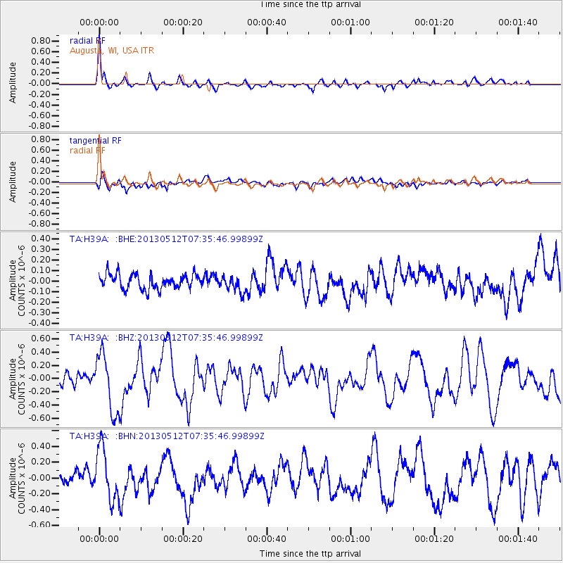
H39A Augusta, WI, USA - Earthquake Result Viewer
*The percent match for this event was below the threshold and hence no stack was calculated.
| Earthquake location: |
Near Coast Of Guatemala |
| Earthquake latitude/longitude: |
13.5/-91.4 |
| Earthquake time(UTC): |
2013/05/12 (132) 07:29:59 GMT |
| Earthquake Depth: |
11 km |
| Earthquake Magnitude: |
5.5 MS, 5.2 MB, 5.8 MW, 5.6 MW |
| Earthquake Catalog/Contributor: |
WHDF/NEIC |
|
| Network: |
TA USArray Transportable Network (new EarthScope stations) |
| Station: |
H39A Augusta, WI, USA |
| Lat/Lon: |
44.68 N/91.28 W |
| Elevation: |
345 m |
|
| Distance: |
31.1 deg |
| Az: |
0.128 deg |
| Baz: |
180.175 deg |
| Ray Param: |
$rayparam |
*The percent match for this event was below the threshold and hence was not used in the summary stack. |
|
| Radial Match: |
79.04762 % |
| Radial Bump: |
400 |
| Transverse Match: |
68.06151 % |
| Transverse Bump: |
400 |
| SOD ConfigId: |
512894 |
| Insert Time: |
2013-09-14 01:26:31.988 +0000 |
| GWidth: |
2.5 |
| Max Bumps: |
400 |
| Tol: |
0.001 |
|
Signal To Noise
| Channel | StoN | STA | LTA |
| TA:H39A: :BHZ:20130512T07:35:46.99899Z | 4.3771996 | 4.5128866E-7 | 1.0309986E-7 |
| TA:H39A: :BHN:20130512T07:35:46.99899Z | 4.6155686 | 3.3648422E-7 | 7.2902004E-8 |
| TA:H39A: :BHE:20130512T07:35:46.99899Z | 1.1388993 | 7.788237E-8 | 6.838389E-8 |
| Arrivals |
| Ps | |
| PpPs | |
| PsPs/PpSs | |


