You are here: Home > Network List > US - United States National Seismic Network Stations List
> Station HAWA Hanford, Washington, USA > Earthquake Result Viewer
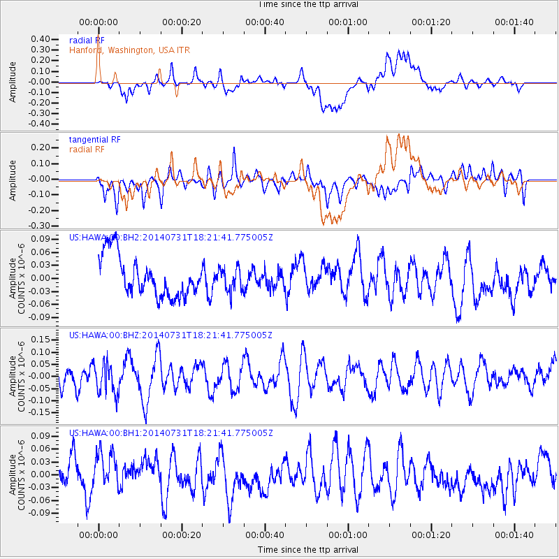
HAWA Hanford, Washington, USA - Earthquake Result Viewer
*The percent match for this event was below the threshold and hence no stack was calculated.
| Earthquake location: |
Mariana Islands |
| Earthquake latitude/longitude: |
14.9/145.5 |
| Earthquake time(UTC): |
2014/07/31 (212) 18:10:02 GMT |
| Earthquake Depth: |
123 km |
| Earthquake Magnitude: |
5.0 mb |
| Earthquake Catalog/Contributor: |
ISC/ISC |
|
| Network: |
US United States National Seismic Network |
| Station: |
HAWA Hanford, Washington, USA |
| Lat/Lon: |
46.39 N/119.53 W |
| Elevation: |
364 m |
|
| Distance: |
82.7 deg |
| Az: |
44.035 deg |
| Baz: |
283.874 deg |
| Ray Param: |
$rayparam |
*The percent match for this event was below the threshold and hence was not used in the summary stack. |
|
| Radial Match: |
38.701687 % |
| Radial Bump: |
400 |
| Transverse Match: |
48.82058 % |
| Transverse Bump: |
400 |
| SOD ConfigId: |
3390531 |
| Insert Time: |
2019-04-13 03:15:49.131 +0000 |
| GWidth: |
2.5 |
| Max Bumps: |
400 |
| Tol: |
0.001 |
|
Signal To Noise
| Channel | StoN | STA | LTA |
| US:HAWA:00:BHZ:20140731T18:21:41.775005Z | 1.2629192 | 6.267233E-8 | 4.9624973E-8 |
| US:HAWA:00:BH1:20140731T18:21:41.775005Z | 1.3436399 | 5.084108E-8 | 3.7838323E-8 |
| US:HAWA:00:BH2:20140731T18:21:41.775005Z | 0.5854162 | 2.7106228E-8 | 4.630249E-8 |
| Arrivals |
| Ps | |
| PpPs | |
| PsPs/PpSs | |


