You are here: Home > Network List > TA - USArray Transportable Network (new EarthScope stations) Stations List
> Station L39A Vinton, IA, USA > Earthquake Result Viewer
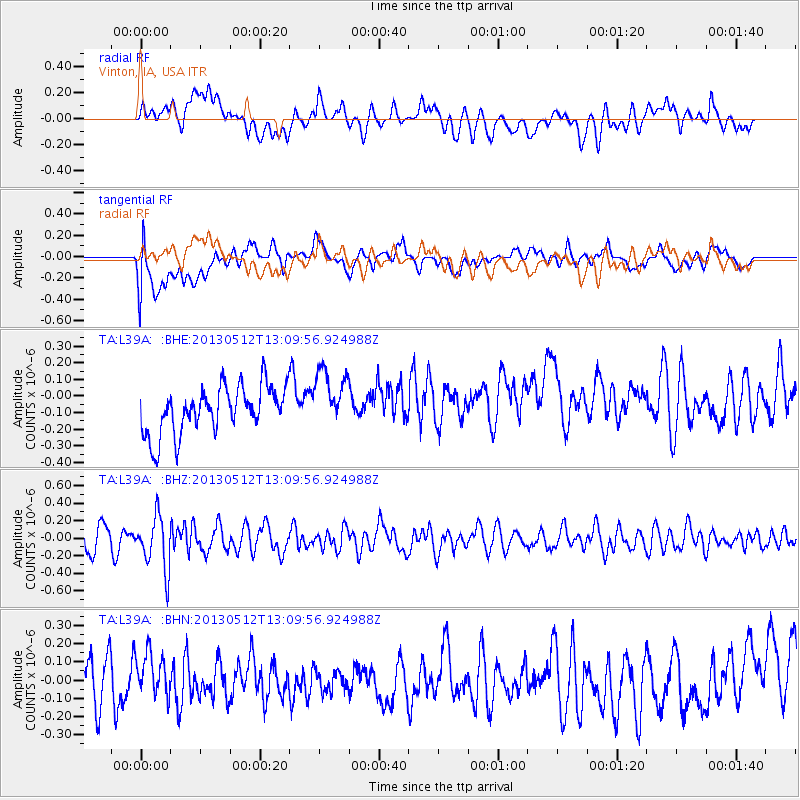
L39A Vinton, IA, USA - Earthquake Result Viewer
*The percent match for this event was below the threshold and hence no stack was calculated.
| Earthquake location: |
Northern Chile |
| Earthquake latitude/longitude: |
-26.2/-69.4 |
| Earthquake time(UTC): |
2013/05/12 (132) 12:59:10 GMT |
| Earthquake Depth: |
10 km |
| Earthquake Magnitude: |
5.5 MB, 4.7 MS, 5.4 MW, 5.1 ML |
| Earthquake Catalog/Contributor: |
WHDF/NEIC |
|
| Network: |
TA USArray Transportable Network (new EarthScope stations) |
| Station: |
L39A Vinton, IA, USA |
| Lat/Lon: |
42.12 N/92.00 W |
| Elevation: |
261 m |
|
| Distance: |
71.1 deg |
| Az: |
342.439 deg |
| Baz: |
158.623 deg |
| Ray Param: |
$rayparam |
*The percent match for this event was below the threshold and hence was not used in the summary stack. |
|
| Radial Match: |
53.82657 % |
| Radial Bump: |
400 |
| Transverse Match: |
53.61116 % |
| Transverse Bump: |
400 |
| SOD ConfigId: |
512894 |
| Insert Time: |
2013-09-14 02:10:10.930 +0000 |
| GWidth: |
2.5 |
| Max Bumps: |
400 |
| Tol: |
0.001 |
|
Signal To Noise
| Channel | StoN | STA | LTA |
| TA:L39A: :BHZ:20130512T13:09:56.924988Z | 2.4029903 | 3.0449607E-7 | 1.2671548E-7 |
| TA:L39A: :BHN:20130512T13:09:56.924988Z | 0.9515186 | 1.1021228E-7 | 1.15827774E-7 |
| TA:L39A: :BHE:20130512T13:09:56.924988Z | 1.2672473 | 1.789576E-7 | 1.4121758E-7 |
| Arrivals |
| Ps | |
| PpPs | |
| PsPs/PpSs | |


