You are here: Home > Network List > PS - Pacific21 Stations List
> Station PSI Parapat, Indonesia > Earthquake Result Viewer
PSI Parapat, Indonesia - Earthquake Result Viewer
*The percent match for this event was below the threshold and hence no stack was calculated.
| Earthquake location: |
Southeast Of Honshu, Japan |
| Earthquake latitude/longitude: |
33.5/138.1 |
| Earthquake time(UTC): |
1998/02/28 (059) 17:38:48 GMT |
| Earthquake Depth: |
291 km |
| Earthquake Magnitude: |
5.7 UNKNOWN, 5.3 MB, 5.7 MW |
| Earthquake Catalog/Contributor: |
WHDF/NEIC |
|
| Network: |
PS Pacific21 |
| Station: |
PSI Parapat, Indonesia |
| Lat/Lon: |
2.69 N/98.92 E |
| Elevation: |
987 m |
|
| Distance: |
47.7 deg |
| Az: |
238.575 deg |
| Baz: |
45.573 deg |
| Ray Param: |
$rayparam |
*The percent match for this event was below the threshold and hence was not used in the summary stack. |
|
| Radial Match: |
72.74994 % |
| Radial Bump: |
400 |
| Transverse Match: |
62.34228 % |
| Transverse Bump: |
400 |
| SOD ConfigId: |
4480 |
| Insert Time: |
2010-02-27 03:29:32.904 +0000 |
| GWidth: |
2.5 |
| Max Bumps: |
400 |
| Tol: |
0.001 |
|
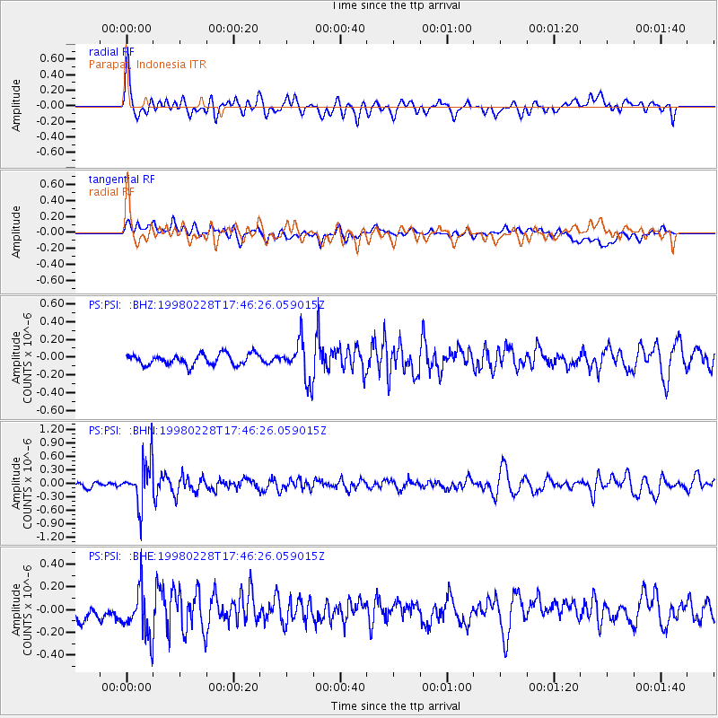
Signal To Noise
| Channel | StoN | STA | LTA |
| PS:PSI: :BHN:19980228T17:46:26.059015Z | 6.9246445 | 4.8412795E-7 | 6.991377E-8 |
| PS:PSI: :BHE:19980228T17:46:26.059015Z | 2.9087126 | 2.1796244E-7 | 7.4934334E-8 |
| PS:PSI: :BHZ:19980228T17:46:26.059015Z | 3.5892081 | 2.2233466E-7 | 6.194532E-8 |
| Arrivals |
| Ps | |
| PpPs | |
| PsPs/PpSs | |


