You are here: Home > Network List > US - United States National Seismic Network Stations List
> Station WMOK Wichita Mountains, Oklahoma, USA > Earthquake Result Viewer
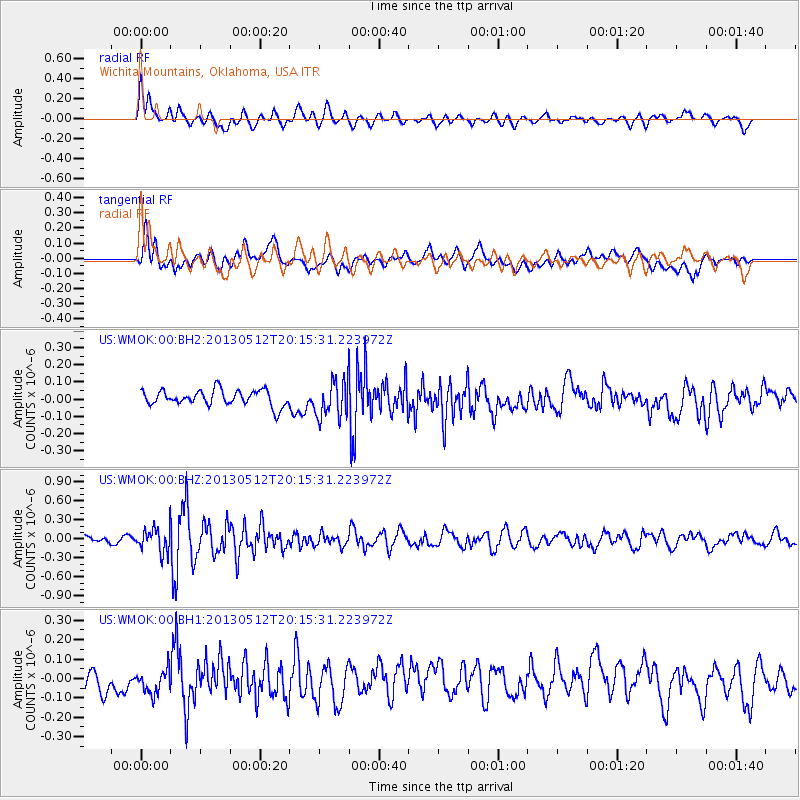
WMOK Wichita Mountains, Oklahoma, USA - Earthquake Result Viewer
*The percent match for this event was below the threshold and hence no stack was calculated.
| Earthquake location: |
Fox Islands, Aleutian Islands |
| Earthquake latitude/longitude: |
52.5/-172.0 |
| Earthquake time(UTC): |
2013/05/12 (132) 20:06:41 GMT |
| Earthquake Depth: |
8.0 km |
| Earthquake Magnitude: |
5.7 MB, 5.1 MS, 5.4 MW, 5.3 MW |
| Earthquake Catalog/Contributor: |
WHDF/NEIC |
|
| Network: |
US United States National Seismic Network |
| Station: |
WMOK Wichita Mountains, Oklahoma, USA |
| Lat/Lon: |
34.74 N/98.78 W |
| Elevation: |
486 m |
|
| Distance: |
53.5 deg |
| Az: |
78.657 deg |
| Baz: |
313.294 deg |
| Ray Param: |
$rayparam |
*The percent match for this event was below the threshold and hence was not used in the summary stack. |
|
| Radial Match: |
64.33397 % |
| Radial Bump: |
400 |
| Transverse Match: |
57.15789 % |
| Transverse Bump: |
400 |
| SOD ConfigId: |
512894 |
| Insert Time: |
2013-09-14 02:56:43.563 +0000 |
| GWidth: |
2.5 |
| Max Bumps: |
400 |
| Tol: |
0.001 |
|
Signal To Noise
| Channel | StoN | STA | LTA |
| US:WMOK:00:BHZ:20130512T20:15:31.223972Z | 2.4875362 | 1.8652953E-7 | 7.498566E-8 |
| US:WMOK:00:BH1:20130512T20:15:31.223972Z | 0.8106465 | 6.056227E-8 | 7.470861E-8 |
| US:WMOK:00:BH2:20130512T20:15:31.223972Z | 2.364471 | 1.0727185E-7 | 4.5368225E-8 |
| Arrivals |
| Ps | |
| PpPs | |
| PsPs/PpSs | |


