You are here: Home > Network List > PS - Pacific21 Stations List
> Station PSI Parapat, Indonesia > Earthquake Result Viewer
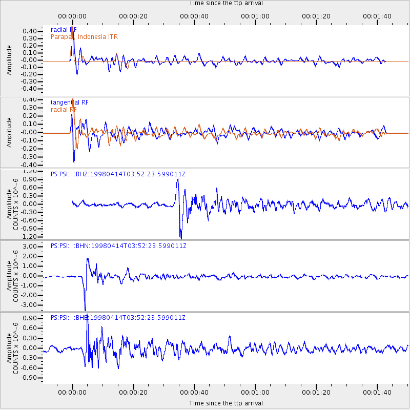
PSI Parapat, Indonesia - Earthquake Result Viewer
*The percent match for this event was below the threshold and hence no stack was calculated.
| Earthquake location: |
South Of Fiji Islands |
| Earthquake latitude/longitude: |
-23.8/-179.9 |
| Earthquake time(UTC): |
1998/04/14 (104) 03:41:22 GMT |
| Earthquake Depth: |
499 km |
| Earthquake Magnitude: |
5.5 MB, 6.2 UNKNOWN, 6.1 MW |
| Earthquake Catalog/Contributor: |
WHDF/NEIC |
|
| Network: |
PS Pacific21 |
| Station: |
PSI Parapat, Indonesia |
| Lat/Lon: |
2.69 N/98.92 E |
| Elevation: |
987 m |
|
| Distance: |
83.0 deg |
| Az: |
276.019 deg |
| Baz: |
114.251 deg |
| Ray Param: |
$rayparam |
*The percent match for this event was below the threshold and hence was not used in the summary stack. |
|
| Radial Match: |
84.787315 % |
| Radial Bump: |
400 |
| Transverse Match: |
75.616165 % |
| Transverse Bump: |
400 |
| SOD ConfigId: |
4480 |
| Insert Time: |
2010-02-27 03:29:56.784 +0000 |
| GWidth: |
2.5 |
| Max Bumps: |
400 |
| Tol: |
0.001 |
|
Signal To Noise
| Channel | StoN | STA | LTA |
| PS:PSI: :BHN:19980414T03:52:23.599011Z | 17.108067 | 1.0482671E-6 | 6.127327E-8 |
| PS:PSI: :BHE:19980414T03:52:23.599011Z | 3.8815708 | 2.3953572E-7 | 6.171103E-8 |
| PS:PSI: :BHZ:19980414T03:52:23.599011Z | 6.8660774 | 3.2173833E-7 | 4.6859114E-8 |
| Arrivals |
| Ps | |
| PpPs | |
| PsPs/PpSs | |


