You are here: Home > Network List > TA - USArray Transportable Network (new EarthScope stations) Stations List
> Station L40A Anamosa, IA, USA > Earthquake Result Viewer
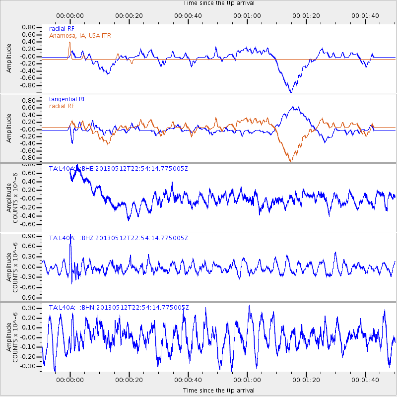
L40A Anamosa, IA, USA - Earthquake Result Viewer
*The percent match for this event was below the threshold and hence no stack was calculated.
| Earthquake location: |
Kuril Islands |
| Earthquake latitude/longitude: |
44.0/147.8 |
| Earthquake time(UTC): |
2013/05/12 (132) 22:42:45 GMT |
| Earthquake Depth: |
54 km |
| Earthquake Magnitude: |
5.6 MB, 5.2 MW, 5.1 MW |
| Earthquake Catalog/Contributor: |
WHDF/NEIC |
|
| Network: |
TA USArray Transportable Network (new EarthScope stations) |
| Station: |
L40A Anamosa, IA, USA |
| Lat/Lon: |
42.06 N/91.22 W |
| Elevation: |
242 m |
|
| Distance: |
79.3 deg |
| Az: |
40.517 deg |
| Baz: |
320.946 deg |
| Ray Param: |
$rayparam |
*The percent match for this event was below the threshold and hence was not used in the summary stack. |
|
| Radial Match: |
26.615702 % |
| Radial Bump: |
400 |
| Transverse Match: |
42.58498 % |
| Transverse Bump: |
400 |
| SOD ConfigId: |
512894 |
| Insert Time: |
2013-09-14 03:31:53.723 +0000 |
| GWidth: |
2.5 |
| Max Bumps: |
400 |
| Tol: |
0.001 |
|
Signal To Noise
| Channel | StoN | STA | LTA |
| TA:L40A: :BHZ:20130512T22:54:14.775005Z | 2.9178112 | 2.965763E-7 | 1.01643415E-7 |
| TA:L40A: :BHN:20130512T22:54:14.775005Z | 0.77257824 | 1.3616557E-7 | 1.7624825E-7 |
| TA:L40A: :BHE:20130512T22:54:14.775005Z | 0.41116908 | 1.3423485E-7 | 3.2647114E-7 |
| Arrivals |
| Ps | |
| PpPs | |
| PsPs/PpSs | |


