You are here: Home > Network List > US - United States National Seismic Network Stations List
> Station DGMT Dagmar, Montana, USA > Earthquake Result Viewer
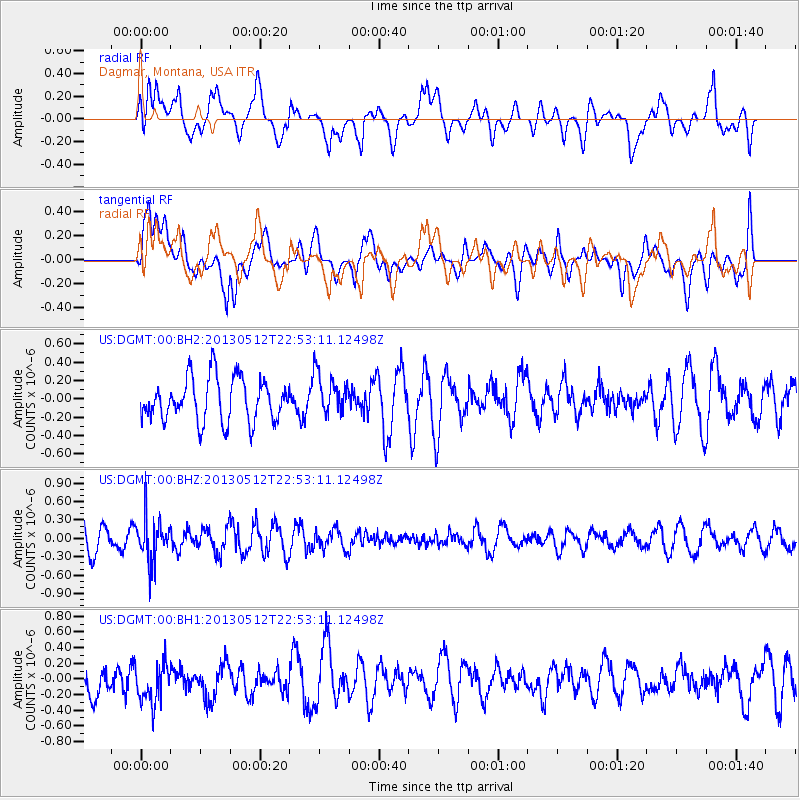
DGMT Dagmar, Montana, USA - Earthquake Result Viewer
*The percent match for this event was below the threshold and hence no stack was calculated.
| Earthquake location: |
Kuril Islands |
| Earthquake latitude/longitude: |
44.0/147.8 |
| Earthquake time(UTC): |
2013/05/12 (132) 22:42:45 GMT |
| Earthquake Depth: |
54 km |
| Earthquake Magnitude: |
5.6 MB, 5.2 MW, 5.1 MW |
| Earthquake Catalog/Contributor: |
WHDF/NEIC |
|
| Network: |
US United States National Seismic Network |
| Station: |
DGMT Dagmar, Montana, USA |
| Lat/Lon: |
48.47 N/104.20 W |
| Elevation: |
0.0 m |
|
| Distance: |
68.4 deg |
| Az: |
42.894 deg |
| Baz: |
312.389 deg |
| Ray Param: |
$rayparam |
*The percent match for this event was below the threshold and hence was not used in the summary stack. |
|
| Radial Match: |
46.34992 % |
| Radial Bump: |
400 |
| Transverse Match: |
60.186913 % |
| Transverse Bump: |
400 |
| SOD ConfigId: |
512894 |
| Insert Time: |
2013-09-14 03:37:59.029 +0000 |
| GWidth: |
2.5 |
| Max Bumps: |
400 |
| Tol: |
0.001 |
|
Signal To Noise
| Channel | StoN | STA | LTA |
| US:DGMT:00:BHZ:20130512T22:53:11.12498Z | 2.005559 | 3.558914E-7 | 1.7745246E-7 |
| US:DGMT:00:BH1:20130512T22:53:11.12498Z | 1.2343707 | 2.6722287E-7 | 2.1648512E-7 |
| US:DGMT:00:BH2:20130512T22:53:11.12498Z | 0.94365513 | 2.2247528E-7 | 2.357591E-7 |
| Arrivals |
| Ps | |
| PpPs | |
| PsPs/PpSs | |


