You are here: Home > Network List > CN - Canadian National Seismograph Network Stations List
> Station FRB IQALUIT, N.W.T. > Earthquake Result Viewer
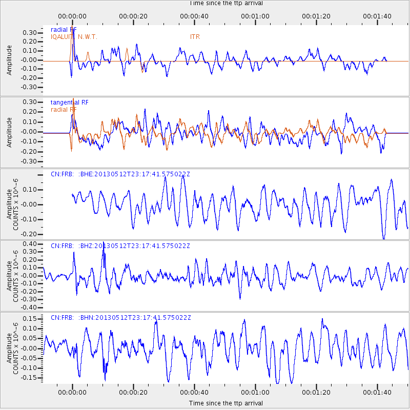
FRB IQALUIT, N.W.T. - Earthquake Result Viewer
*The percent match for this event was below the threshold and hence no stack was calculated.
| Earthquake location: |
Mariana Islands Region |
| Earthquake latitude/longitude: |
21.9/143.7 |
| Earthquake time(UTC): |
2013/05/12 (132) 23:05:27 GMT |
| Earthquake Depth: |
167 km |
| Earthquake Magnitude: |
5.5 MW, 5.1 MB, 5.6 MW |
| Earthquake Catalog/Contributor: |
WHDF/NEIC |
|
| Network: |
CN Canadian National Seismograph Network |
| Station: |
FRB IQALUIT, N.W.T. |
| Lat/Lon: |
63.75 N/68.55 W |
| Elevation: |
18 m |
|
| Distance: |
90.9 deg |
| Az: |
13.746 deg |
| Baz: |
330.261 deg |
| Ray Param: |
$rayparam |
*The percent match for this event was below the threshold and hence was not used in the summary stack. |
|
| Radial Match: |
57.245647 % |
| Radial Bump: |
400 |
| Transverse Match: |
53.513653 % |
| Transverse Bump: |
400 |
| SOD ConfigId: |
512894 |
| Insert Time: |
2013-09-14 03:51:01.247 +0000 |
| GWidth: |
2.5 |
| Max Bumps: |
400 |
| Tol: |
0.001 |
|
Signal To Noise
| Channel | StoN | STA | LTA |
| CN:FRB: :BHZ:20130512T23:17:41.575022Z | 1.163368 | 1.0860408E-7 | 9.335316E-8 |
| CN:FRB: :BHN:20130512T23:17:41.575022Z | 1.7948133 | 6.8097556E-8 | 3.7941305E-8 |
| CN:FRB: :BHE:20130512T23:17:41.575022Z | 1.6040221 | 9.3911694E-8 | 5.854763E-8 |
| Arrivals |
| Ps | |
| PpPs | |
| PsPs/PpSs | |


