You are here: Home > Network List > IU - Global Seismograph Network (GSN - IRIS/USGS) Stations List
> Station POHA Pohakuloa, Hawaii, USA > Earthquake Result Viewer
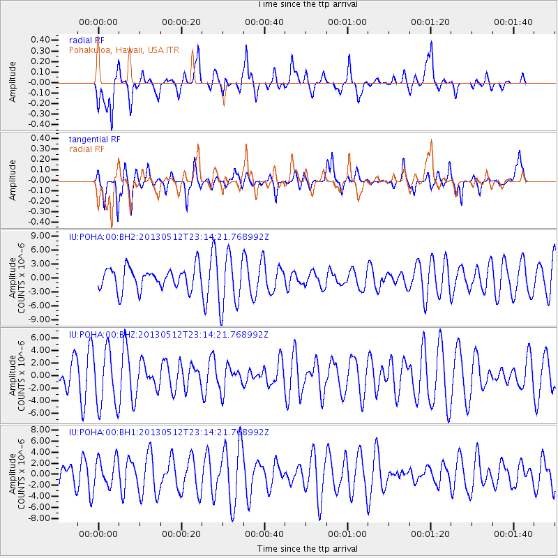
POHA Pohakuloa, Hawaii, USA - Earthquake Result Viewer
*The percent match for this event was below the threshold and hence no stack was calculated.
| Earthquake location: |
Mariana Islands Region |
| Earthquake latitude/longitude: |
21.9/143.7 |
| Earthquake time(UTC): |
2013/05/12 (132) 23:05:27 GMT |
| Earthquake Depth: |
167 km |
| Earthquake Magnitude: |
5.5 MW, 5.1 MB, 5.6 MW |
| Earthquake Catalog/Contributor: |
WHDF/NEIC |
|
| Network: |
IU Global Seismograph Network (GSN - IRIS/USGS) |
| Station: |
POHA Pohakuloa, Hawaii, USA |
| Lat/Lon: |
19.76 N/155.53 W |
| Elevation: |
1990 m |
|
| Distance: |
56.5 deg |
| Az: |
80.27 deg |
| Baz: |
283.694 deg |
| Ray Param: |
$rayparam |
*The percent match for this event was below the threshold and hence was not used in the summary stack. |
|
| Radial Match: |
43.677605 % |
| Radial Bump: |
347 |
| Transverse Match: |
58.87155 % |
| Transverse Bump: |
357 |
| SOD ConfigId: |
512894 |
| Insert Time: |
2013-09-14 03:55:42.926 +0000 |
| GWidth: |
2.5 |
| Max Bumps: |
400 |
| Tol: |
0.001 |
|
Signal To Noise
| Channel | StoN | STA | LTA |
| IU:POHA:00:BHZ:20130512T23:14:21.768992Z | 2.101425 | 4.619676E-6 | 2.198354E-6 |
| IU:POHA:00:BH1:20130512T23:14:21.768992Z | 0.8261227 | 2.49187E-6 | 3.0163437E-6 |
| IU:POHA:00:BH2:20130512T23:14:21.768992Z | 2.4403517 | 5.710117E-6 | 2.3398745E-6 |
| Arrivals |
| Ps | |
| PpPs | |
| PsPs/PpSs | |


