You are here: Home > Network List > US - United States National Seismic Network Stations List
> Station MNTX Cornudas Mountains, Texas, USA > Earthquake Result Viewer
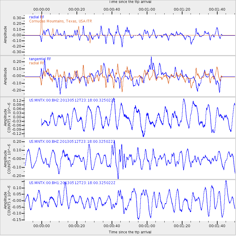
MNTX Cornudas Mountains, Texas, USA - Earthquake Result Viewer
*The percent match for this event was below the threshold and hence no stack was calculated.
| Earthquake location: |
Mariana Islands Region |
| Earthquake latitude/longitude: |
21.9/143.7 |
| Earthquake time(UTC): |
2013/05/12 (132) 23:05:27 GMT |
| Earthquake Depth: |
167 km |
| Earthquake Magnitude: |
5.5 MW, 5.1 MB, 5.6 MW |
| Earthquake Catalog/Contributor: |
WHDF/NEIC |
|
| Network: |
US United States National Seismic Network |
| Station: |
MNTX Cornudas Mountains, Texas, USA |
| Lat/Lon: |
31.70 N/105.38 W |
| Elevation: |
404 m |
|
| Distance: |
95.0 deg |
| Az: |
53.086 deg |
| Baz: |
299.442 deg |
| Ray Param: |
$rayparam |
*The percent match for this event was below the threshold and hence was not used in the summary stack. |
|
| Radial Match: |
48.980064 % |
| Radial Bump: |
400 |
| Transverse Match: |
54.756634 % |
| Transverse Bump: |
400 |
| SOD ConfigId: |
512894 |
| Insert Time: |
2013-09-14 04:02:53.796 +0000 |
| GWidth: |
2.5 |
| Max Bumps: |
400 |
| Tol: |
0.001 |
|
Signal To Noise
| Channel | StoN | STA | LTA |
| US:MNTX:00:BHZ:20130512T23:18:00.325022Z | 0.9062018 | 5.583112E-8 | 6.161003E-8 |
| US:MNTX:00:BH1:20130512T23:18:00.325022Z | 0.68189096 | 2.5890852E-8 | 3.7969198E-8 |
| US:MNTX:00:BH2:20130512T23:18:00.325022Z | 1.7238408 | 6.408967E-8 | 3.7178413E-8 |
| Arrivals |
| Ps | |
| PpPs | |
| PsPs/PpSs | |


