You are here: Home > Network List > UU - University of Utah Regional Network Stations List
> Station KNB Kanab, UT, USA > Earthquake Result Viewer
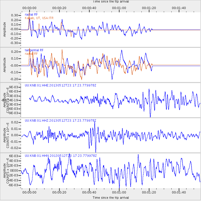
KNB Kanab, UT, USA - Earthquake Result Viewer
*The percent match for this event was below the threshold and hence no stack was calculated.
| Earthquake location: |
Mariana Islands Region |
| Earthquake latitude/longitude: |
21.9/143.7 |
| Earthquake time(UTC): |
2013/05/12 (132) 23:05:27 GMT |
| Earthquake Depth: |
167 km |
| Earthquake Magnitude: |
5.5 MW, 5.1 MB, 5.6 MW |
| Earthquake Catalog/Contributor: |
WHDF/NEIC |
|
| Network: |
UU University of Utah Regional Network |
| Station: |
KNB Kanab, UT, USA |
| Lat/Lon: |
37.02 N/112.82 W |
| Elevation: |
1715 m |
|
| Distance: |
87.1 deg |
| Az: |
51.213 deg |
| Baz: |
295.289 deg |
| Ray Param: |
$rayparam |
*The percent match for this event was below the threshold and hence was not used in the summary stack. |
|
| Radial Match: |
65.06043 % |
| Radial Bump: |
400 |
| Transverse Match: |
48.326202 % |
| Transverse Bump: |
400 |
| SOD ConfigId: |
512894 |
| Insert Time: |
2013-09-14 04:03:34.860 +0000 |
| GWidth: |
2.5 |
| Max Bumps: |
400 |
| Tol: |
0.001 |
|
Signal To Noise
| Channel | StoN | STA | LTA |
| UU:KNB:01:HHZ:20130512T23:17:23.779978Z | 3.0704613 | 5.1210547E-9 | 1.6678454E-9 |
| UU:KNB:01:HHN:20130512T23:17:23.779978Z | 1.523141 | 3.522389E-9 | 2.3125823E-9 |
| UU:KNB:01:HHE:20130512T23:17:23.779978Z | 1.0437071 | 1.3085676E-9 | 1.253769E-9 |
| Arrivals |
| Ps | |
| PpPs | |
| PsPs/PpSs | |


