You are here: Home > Network List > US - United States National Seismic Network Stations List
> Station MNTX Cornudas Mountains, Texas, USA > Earthquake Result Viewer
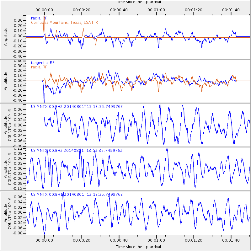
MNTX Cornudas Mountains, Texas, USA - Earthquake Result Viewer
*The percent match for this event was below the threshold and hence no stack was calculated.
| Earthquake location: |
Tonga Islands |
| Earthquake latitude/longitude: |
-17.6/-173.6 |
| Earthquake time(UTC): |
2014/08/01 (213) 13:01:52 GMT |
| Earthquake Depth: |
39 km |
| Earthquake Magnitude: |
5.0 MW |
| Earthquake Catalog/Contributor: |
ISC/ISC |
|
| Network: |
US United States National Seismic Network |
| Station: |
MNTX Cornudas Mountains, Texas, USA |
| Lat/Lon: |
31.70 N/105.38 W |
| Elevation: |
404 m |
|
| Distance: |
81.7 deg |
| Az: |
53.135 deg |
| Baz: |
243.529 deg |
| Ray Param: |
$rayparam |
*The percent match for this event was below the threshold and hence was not used in the summary stack. |
|
| Radial Match: |
54.423508 % |
| Radial Bump: |
400 |
| Transverse Match: |
43.41658 % |
| Transverse Bump: |
400 |
| SOD ConfigId: |
3390531 |
| Insert Time: |
2019-04-13 03:42:47.150 +0000 |
| GWidth: |
2.5 |
| Max Bumps: |
400 |
| Tol: |
0.001 |
|
Signal To Noise
| Channel | StoN | STA | LTA |
| US:MNTX:00:BHZ:20140801T13:13:35.749976Z | 1.7983125 | 7.813821E-8 | 4.345085E-8 |
| US:MNTX:00:BH1:20140801T13:13:35.749976Z | 1.2912952 | 5.366737E-8 | 4.1560885E-8 |
| US:MNTX:00:BH2:20140801T13:13:35.749976Z | 1.0218139 | 2.788875E-8 | 2.7293376E-8 |
| Arrivals |
| Ps | |
| PpPs | |
| PsPs/PpSs | |


