You are here: Home > Network List > IU - Global Seismograph Network (GSN - IRIS/USGS) Stations List
> Station JOHN Johnston Island, USA > Earthquake Result Viewer
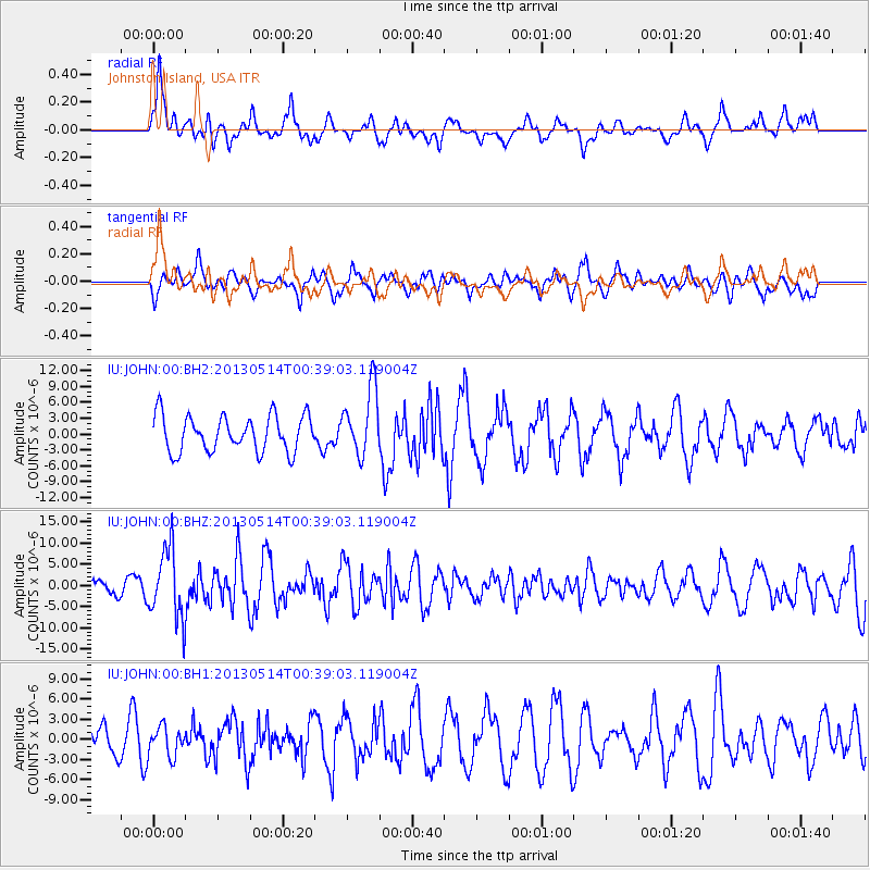
JOHN Johnston Island, USA - Earthquake Result Viewer
*The percent match for this event was below the threshold and hence no stack was calculated.
| Earthquake location: |
Mariana Islands |
| Earthquake latitude/longitude: |
18.7/145.3 |
| Earthquake time(UTC): |
2013/05/14 (134) 00:32:25 GMT |
| Earthquake Depth: |
602 km |
| Earthquake Magnitude: |
6.8 MW, 6.2 MB, 6.8 MW |
| Earthquake Catalog/Contributor: |
NEIC PDE/NEIC PDE-W |
|
| Network: |
IU Global Seismograph Network (GSN - IRIS/USGS) |
| Station: |
JOHN Johnston Island, USA |
| Lat/Lon: |
16.73 N/169.53 W |
| Elevation: |
2.0 m |
|
| Distance: |
43.0 deg |
| Az: |
85.321 deg |
| Baz: |
279.679 deg |
| Ray Param: |
$rayparam |
*The percent match for this event was below the threshold and hence was not used in the summary stack. |
|
| Radial Match: |
62.71007 % |
| Radial Bump: |
400 |
| Transverse Match: |
73.92058 % |
| Transverse Bump: |
400 |
| SOD ConfigId: |
512894 |
| Insert Time: |
2013-09-14 04:22:31.499 +0000 |
| GWidth: |
2.5 |
| Max Bumps: |
400 |
| Tol: |
0.001 |
|
Signal To Noise
| Channel | StoN | STA | LTA |
| IU:JOHN:00:BHZ:20130514T00:39:03.119004Z | 4.512949 | 8.201651E-6 | 1.8173597E-6 |
| IU:JOHN:00:BH1:20130514T00:39:03.119004Z | 1.0601462 | 2.1731987E-6 | 2.0499049E-6 |
| IU:JOHN:00:BH2:20130514T00:39:03.119004Z | 1.8842218 | 6.397288E-6 | 3.3951885E-6 |
| Arrivals |
| Ps | |
| PpPs | |
| PsPs/PpSs | |


