HEH Heihe,Heilongjiang Province - Earthquake Result Viewer
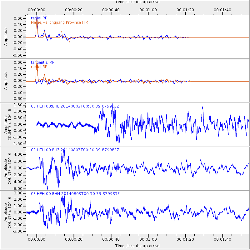
Earthquake location: E. Caroline Islands, Micronesia
Earthquake latitude/longitude: 0.8/146.1
Earthquake time(UTC): 2014/08/03 (215) 00:22:03 GMT
Earthquake Depth: 11 km
Earthquake Magnitude: 6.9 MWW, 6.8 MWB, 6.9 MWC, 7.2 MI
Earthquake Catalog/Contributor: NEIC PDE/NEIC COMCAT
Network: CB China National Seismic Network
Station: HEH Heihe,Heilongjiang Province
Lat/Lon: 50.25 N/127.41 E
Elevation: 165 m
Distance: 51.8 deg
Az: 344.779 deg
Baz: 155.862 deg
Ray Param: 0.0672067
Estimated Moho Depth: 32.25 km
Estimated Crust Vp/Vs: 1.78
Assumed Crust Vp: 6.419 km/s
Estimated Crust Vs: 3.611 km/s
Estimated Crust Poisson's Ratio: 0.27
Radial Match: 94.60946 %
Radial Bump: 265
Transverse Match: 76.9247 %
Transverse Bump: 400
SOD ConfigId: 3390531
Insert Time: 2019-04-13 04:02:39.488 +0000
GWidth: 2.5
Max Bumps: 400
Tol: 0.001

Signal To Noise

ChannelStoNSTALTA
CB:HEH:00:BHZ:20140803T00:30:39.879983Z19.4620952.1926055E-61.126603E-7
CB:HEH:00:BHN:20140803T00:30:39.879983Z12.5268319.550824E-77.624294E-8
CB:HEH:00:BHE:20140803T00:30:39.879983Z4.05660534.4232053E-71.0903711E-7
Arrivals
Ps4.1 SECOND
PpPs13 SECOND
PsPs/PpSs17 SECOND