You are here: Home > Network List > TA - USArray Transportable Network (new EarthScope stations) Stations List
> Station 252A Lumpkin, GA, USA > Earthquake Result Viewer
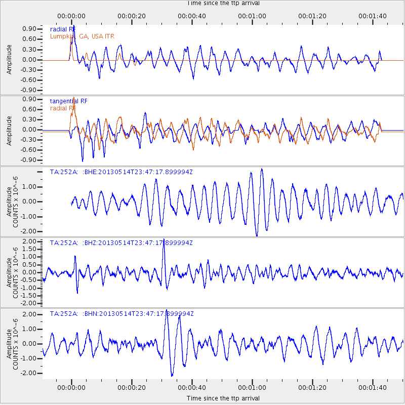
252A Lumpkin, GA, USA - Earthquake Result Viewer
*The percent match for this event was below the threshold and hence no stack was calculated.
| Earthquake location: |
Southern Peru |
| Earthquake latitude/longitude: |
-15.7/-73.3 |
| Earthquake time(UTC): |
2013/05/14 (134) 23:39:15 GMT |
| Earthquake Depth: |
105 km |
| Earthquake Magnitude: |
5.5 MW, 5.5 MW, 5.7 MB |
| Earthquake Catalog/Contributor: |
NEIC PDE/NEIC PDE-W |
|
| Network: |
TA USArray Transportable Network (new EarthScope stations) |
| Station: |
252A Lumpkin, GA, USA |
| Lat/Lon: |
32.00 N/84.74 W |
| Elevation: |
142 m |
|
| Distance: |
48.7 deg |
| Az: |
347.068 deg |
| Baz: |
165.303 deg |
| Ray Param: |
$rayparam |
*The percent match for this event was below the threshold and hence was not used in the summary stack. |
|
| Radial Match: |
58.76914 % |
| Radial Bump: |
385 |
| Transverse Match: |
72.61619 % |
| Transverse Bump: |
344 |
| SOD ConfigId: |
512894 |
| Insert Time: |
2013-09-14 05:13:17.975 +0000 |
| GWidth: |
2.5 |
| Max Bumps: |
400 |
| Tol: |
0.001 |
|
Signal To Noise
| Channel | StoN | STA | LTA |
| TA:252A: :BHZ:20130514T23:47:17.899994Z | 2.4573445 | 4.7414198E-7 | 1.9294892E-7 |
| TA:252A: :BHN:20130514T23:47:17.899994Z | 0.7403024 | 4.2356984E-7 | 5.721579E-7 |
| TA:252A: :BHE:20130514T23:47:17.899994Z | 1.7941314 | 8.295407E-7 | 4.623634E-7 |
| Arrivals |
| Ps | |
| PpPs | |
| PsPs/PpSs | |


